You are here: Home > Network List > TA - USArray Transportable Network (new EarthScope stations) Stations List
> Station I17K Unalakleet, AK, USA > Earthquake Result Viewer
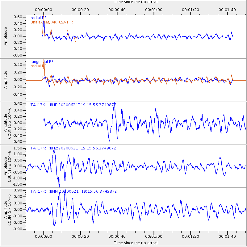
I17K Unalakleet, AK, USA - Earthquake Result Viewer
*The percent match for this event was below the threshold and hence no stack was calculated.
| Earthquake location: |
Iceland Region |
| Earthquake latitude/longitude: |
66.4/-18.7 |
| Earthquake time(UTC): |
2020/06/21 (173) 19:07:55 GMT |
| Earthquake Depth: |
10 km |
| Earthquake Magnitude: |
6.0 mww |
| Earthquake Catalog/Contributor: |
NEIC PDE/us |
|
| Network: |
TA USArray Transportable Network (new EarthScope stations) |
| Station: |
I17K Unalakleet, AK, USA |
| Lat/Lon: |
63.89 N/160.70 W |
| Elevation: |
105 m |
|
| Distance: |
47.1 deg |
| Az: |
338.181 deg |
| Baz: |
19.772 deg |
| Ray Param: |
$rayparam |
*The percent match for this event was below the threshold and hence was not used in the summary stack. |
|
| Radial Match: |
73.704506 % |
| Radial Bump: |
400 |
| Transverse Match: |
70.73794 % |
| Transverse Bump: |
400 |
| SOD ConfigId: |
21709731 |
| Insert Time: |
2020-07-05 19:36:03.860 +0000 |
| GWidth: |
2.5 |
| Max Bumps: |
400 |
| Tol: |
0.001 |
|
Signal To Noise
| Channel | StoN | STA | LTA |
| TA:I17K: :BHZ:20200621T19:15:56.374987Z | 1.9504567 | 3.2358545E-7 | 1.659024E-7 |
| TA:I17K: :BHN:20200621T19:15:56.374987Z | 1.1996213 | 1.2188843E-7 | 1.0160576E-7 |
| TA:I17K: :BHE:20200621T19:15:56.374987Z | 1.0340495 | 7.051124E-8 | 6.818942E-8 |
| Arrivals |
| Ps | |
| PpPs | |
| PsPs/PpSs | |


