You are here: Home > Network List > US - United States National Seismic Network Stations List
> Station WMOK Wichita Mountains, Oklahoma, USA > Earthquake Result Viewer
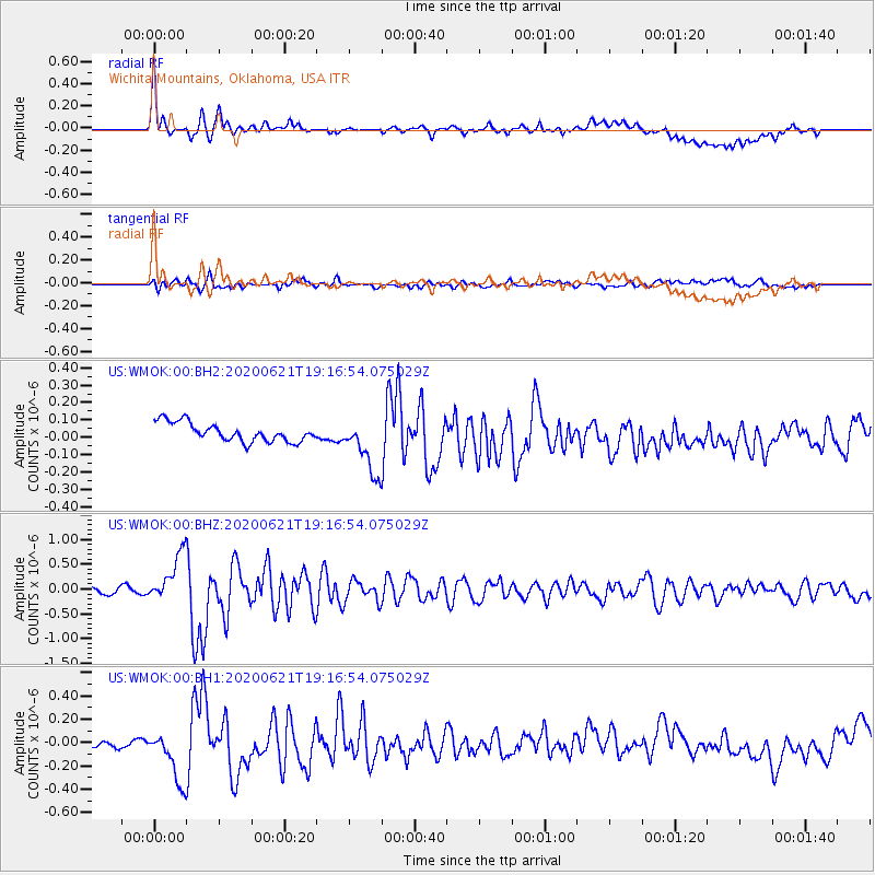
WMOK Wichita Mountains, Oklahoma, USA - Earthquake Result Viewer
*The percent match for this event was below the threshold and hence no stack was calculated.
| Earthquake location: |
Iceland Region |
| Earthquake latitude/longitude: |
66.4/-18.7 |
| Earthquake time(UTC): |
2020/06/21 (173) 19:07:55 GMT |
| Earthquake Depth: |
10 km |
| Earthquake Magnitude: |
6.0 mww |
| Earthquake Catalog/Contributor: |
NEIC PDE/us |
|
| Network: |
US United States National Seismic Network |
| Station: |
WMOK Wichita Mountains, Oklahoma, USA |
| Lat/Lon: |
34.74 N/98.78 W |
| Elevation: |
486 m |
|
| Distance: |
54.8 deg |
| Az: |
276.943 deg |
| Baz: |
29.045 deg |
| Ray Param: |
$rayparam |
*The percent match for this event was below the threshold and hence was not used in the summary stack. |
|
| Radial Match: |
54.122467 % |
| Radial Bump: |
400 |
| Transverse Match: |
52.363026 % |
| Transverse Bump: |
400 |
| SOD ConfigId: |
21709731 |
| Insert Time: |
2020-07-05 19:40:47.059 +0000 |
| GWidth: |
2.5 |
| Max Bumps: |
400 |
| Tol: |
0.001 |
|
Signal To Noise
| Channel | StoN | STA | LTA |
| US:WMOK:00:BHZ:20200621T19:16:54.075029Z | 10.374353 | 4.870873E-7 | 4.6951097E-8 |
| US:WMOK:00:BH1:20200621T19:16:54.075029Z | 1.2684609 | 3.2252638E-7 | 2.5426593E-7 |
| US:WMOK:00:BH2:20200621T19:16:54.075029Z | 3.0338123 | 1.6201662E-7 | 5.340364E-8 |
| Arrivals |
| Ps | |
| PpPs | |
| PsPs/PpSs | |


