You are here: Home > Network List > CN - Canadian National Seismograph Network Stations List
> Station INK INUVIK, NT > Earthquake Result Viewer
INK INUVIK, NT - Earthquake Result Viewer
*The percent match for this event was below the threshold and hence no stack was calculated.
| Earthquake location: |
Myanmar-India Border Region |
| Earthquake latitude/longitude: |
23.1/93.3 |
| Earthquake time(UTC): |
2020/06/21 (173) 22:40:52 GMT |
| Earthquake Depth: |
13 km |
| Earthquake Magnitude: |
5.6 Mww |
| Earthquake Catalog/Contributor: |
NEIC PDE/us |
|
| Network: |
CN Canadian National Seismograph Network |
| Station: |
INK INUVIK, NT |
| Lat/Lon: |
68.31 N/133.53 W |
| Elevation: |
44 m |
|
| Distance: |
82.6 deg |
| Az: |
15.858 deg |
| Baz: |
317.422 deg |
| Ray Param: |
$rayparam |
*The percent match for this event was below the threshold and hence was not used in the summary stack. |
|
| Radial Match: |
69.47069 % |
| Radial Bump: |
400 |
| Transverse Match: |
61.956196 % |
| Transverse Bump: |
400 |
| SOD ConfigId: |
21709731 |
| Insert Time: |
2020-07-05 22:45:56.632 +0000 |
| GWidth: |
2.5 |
| Max Bumps: |
400 |
| Tol: |
0.001 |
|
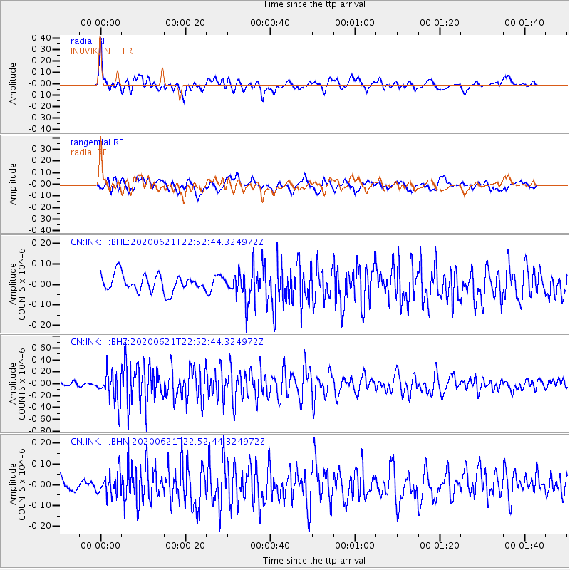
Signal To Noise
| Channel | StoN | STA | LTA |
| CN:INK: :BHZ:20200621T22:52:44.324972Z | 7.003905 | 2.5407752E-7 | 3.627655E-8 |
| CN:INK: :BHN:20200621T22:52:44.324972Z | 1.3367845 | 5.4694198E-8 | 4.0914745E-8 |
| CN:INK: :BHE:20200621T22:52:44.324972Z | 1.7352661 | 7.071094E-8 | 4.0749338E-8 |
| Arrivals |
| Ps | |
| PpPs | |
| PsPs/PpSs | |


