ULHL KN.ULHL - Earthquake Result Viewer
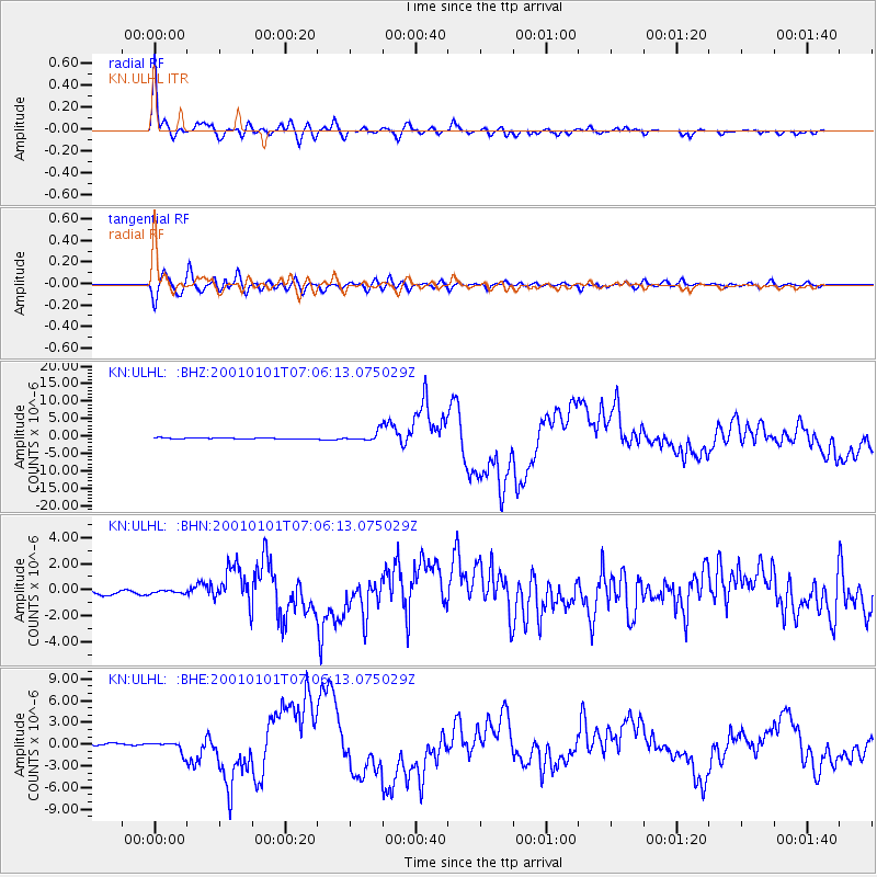
Earthquake location: Mindanao, Philippines
Earthquake latitude/longitude: 6.9/126.6
Earthquake time(UTC): 2001/01/01 (001) 06:57:04 GMT
Earthquake Depth: 33 km
Earthquake Magnitude: 6.4 MB, 7.2 MS, 7.5 MW, 7.3 ME
Earthquake Catalog/Contributor: WHDF/NEIC
Network: KN Kyrgyz Seismic Telemetry Network
Station: ULHL KN.ULHL
Lat/Lon: 42.25 N/76.24 E
Elevation: 2040 m
Distance: 56.6 deg
Az: 316.791 deg
Baz: 113.724 deg
Ray Param: 0.06397585
Estimated Moho Depth: 44.75 km
Estimated Crust Vp/Vs: 2.10
Assumed Crust Vp: 6.306 km/s
Estimated Crust Vs: 3.006 km/s
Estimated Crust Poisson's Ratio: 0.35
Radial Match: 96.85022 %
Radial Bump: 400
Transverse Match: 92.22423 %
Transverse Bump: 400
SOD ConfigId: 3744
Insert Time: 2010-03-08 21:58:15.631 +0000
GWidth: 2.5
Max Bumps: 400
Tol: 0.001

Signal To Noise

ChannelStoNSTALTA
KN:ULHL: :BHN:20010101T07:06:13.075029Z0.523484351.14013815E-72.1779795E-7
KN:ULHL: :BHE:20010101T07:06:13.075029Z3.63622677.320976E-72.0133442E-7
KN:ULHL: :BHZ:20010101T07:06:13.075029Z7.56649831.3131302E-61.735453E-7
Arrivals
Ps8.1 SECOND
PpPs21 SECOND
PsPs/PpSs29 SECOND