You are here: Home > Network List > TA - USArray Transportable Network (new EarthScope stations) Stations List
> Station B22K Teshekpuk Lake, AK, USA > Earthquake Result Viewer
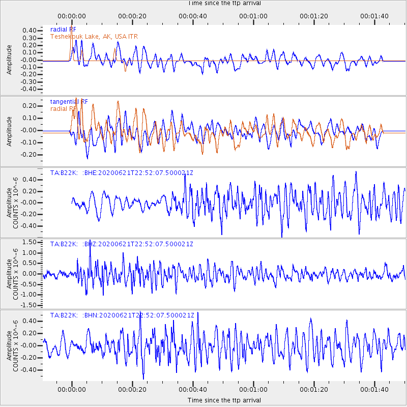
B22K Teshekpuk Lake, AK, USA - Earthquake Result Viewer
*The percent match for this event was below the threshold and hence no stack was calculated.
| Earthquake location: |
Myanmar-India Border Region |
| Earthquake latitude/longitude: |
23.1/93.3 |
| Earthquake time(UTC): |
2020/06/21 (173) 22:40:52 GMT |
| Earthquake Depth: |
13 km |
| Earthquake Magnitude: |
5.6 Mww |
| Earthquake Catalog/Contributor: |
NEIC PDE/us |
|
| Network: |
TA USArray Transportable Network (new EarthScope stations) |
| Station: |
B22K Teshekpuk Lake, AK, USA |
| Lat/Lon: |
70.34 N/153.42 W |
| Elevation: |
50 m |
|
| Distance: |
75.9 deg |
| Az: |
18.694 deg |
| Baz: |
299.329 deg |
| Ray Param: |
$rayparam |
*The percent match for this event was below the threshold and hence was not used in the summary stack. |
|
| Radial Match: |
68.36255 % |
| Radial Bump: |
400 |
| Transverse Match: |
66.79422 % |
| Transverse Bump: |
400 |
| SOD ConfigId: |
21709731 |
| Insert Time: |
2020-07-05 22:49:46.456 +0000 |
| GWidth: |
2.5 |
| Max Bumps: |
400 |
| Tol: |
0.001 |
|
Signal To Noise
| Channel | StoN | STA | LTA |
| TA:B22K: :BHZ:20200621T22:52:07.500021Z | 2.9349456 | 3.0902106E-7 | 1.0529021E-7 |
| TA:B22K: :BHN:20200621T22:52:07.500021Z | 0.5462192 | 6.0553674E-8 | 1.10859645E-7 |
| TA:B22K: :BHE:20200621T22:52:07.500021Z | 1.053897 | 1.1707967E-7 | 1.11092135E-7 |
| Arrivals |
| Ps | |
| PpPs | |
| PsPs/PpSs | |


