You are here: Home > Network List > TA - USArray Transportable Network (new EarthScope stations) Stations List
> Station C16K Lisburne Hills, AK, USA > Earthquake Result Viewer
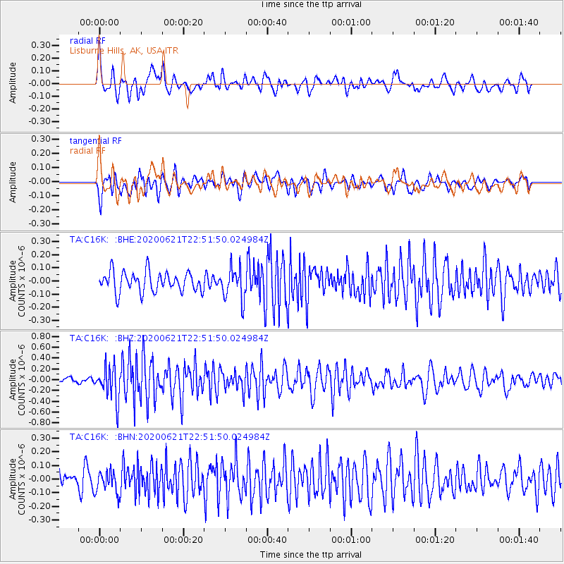
C16K Lisburne Hills, AK, USA - Earthquake Result Viewer
*The percent match for this event was below the threshold and hence no stack was calculated.
| Earthquake location: |
Myanmar-India Border Region |
| Earthquake latitude/longitude: |
23.1/93.3 |
| Earthquake time(UTC): |
2020/06/21 (173) 22:40:52 GMT |
| Earthquake Depth: |
13 km |
| Earthquake Magnitude: |
5.6 Mww |
| Earthquake Catalog/Contributor: |
NEIC PDE/us |
|
| Network: |
TA USArray Transportable Network (new EarthScope stations) |
| Station: |
C16K Lisburne Hills, AK, USA |
| Lat/Lon: |
68.27 N/165.34 W |
| Elevation: |
102 m |
|
| Distance: |
72.9 deg |
| Az: |
22.455 deg |
| Baz: |
289.191 deg |
| Ray Param: |
$rayparam |
*The percent match for this event was below the threshold and hence was not used in the summary stack. |
|
| Radial Match: |
69.18132 % |
| Radial Bump: |
400 |
| Transverse Match: |
67.40852 % |
| Transverse Bump: |
400 |
| SOD ConfigId: |
21709731 |
| Insert Time: |
2020-07-05 22:49:46.642 +0000 |
| GWidth: |
2.5 |
| Max Bumps: |
400 |
| Tol: |
0.001 |
|
Signal To Noise
| Channel | StoN | STA | LTA |
| TA:C16K: :BHZ:20200621T22:51:50.024984Z | 4.3189387 | 3.1439066E-7 | 7.27935E-8 |
| TA:C16K: :BHN:20200621T22:51:50.024984Z | 1.035319 | 7.903884E-8 | 7.63425E-8 |
| TA:C16K: :BHE:20200621T22:51:50.024984Z | 1.6101557 | 1.2276273E-7 | 7.624276E-8 |
| Arrivals |
| Ps | |
| PpPs | |
| PsPs/PpSs | |


