You are here: Home > Network List > TA - USArray Transportable Network (new EarthScope stations) Stations List
> Station D25K Kavik River, AK, USA > Earthquake Result Viewer
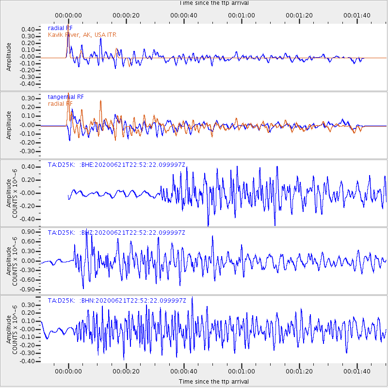
D25K Kavik River, AK, USA - Earthquake Result Viewer
*The percent match for this event was below the threshold and hence no stack was calculated.
| Earthquake location: |
Myanmar-India Border Region |
| Earthquake latitude/longitude: |
23.1/93.3 |
| Earthquake time(UTC): |
2020/06/21 (173) 22:40:52 GMT |
| Earthquake Depth: |
13 km |
| Earthquake Magnitude: |
5.6 Mww |
| Earthquake Catalog/Contributor: |
NEIC PDE/us |
|
| Network: |
TA USArray Transportable Network (new EarthScope stations) |
| Station: |
D25K Kavik River, AK, USA |
| Lat/Lon: |
69.32 N/146.38 W |
| Elevation: |
770 m |
|
| Distance: |
78.5 deg |
| Az: |
18.228 deg |
| Baz: |
305.834 deg |
| Ray Param: |
$rayparam |
*The percent match for this event was below the threshold and hence was not used in the summary stack. |
|
| Radial Match: |
78.82433 % |
| Radial Bump: |
400 |
| Transverse Match: |
82.835266 % |
| Transverse Bump: |
400 |
| SOD ConfigId: |
21709731 |
| Insert Time: |
2020-07-05 22:50:04.213 +0000 |
| GWidth: |
2.5 |
| Max Bumps: |
400 |
| Tol: |
0.001 |
|
Signal To Noise
| Channel | StoN | STA | LTA |
| TA:D25K: :BHZ:20200621T22:52:22.099997Z | 4.5602956 | 1.9819016E-7 | 4.3459934E-8 |
| TA:D25K: :BHN:20200621T22:52:22.099997Z | 1.3632119 | 6.071599E-8 | 4.4538925E-8 |
| TA:D25K: :BHE:20200621T22:52:22.099997Z | 1.7752454 | 6.014599E-8 | 3.3880383E-8 |
| Arrivals |
| Ps | |
| PpPs | |
| PsPs/PpSs | |


