ULHL KN.ULHL - Earthquake Result Viewer
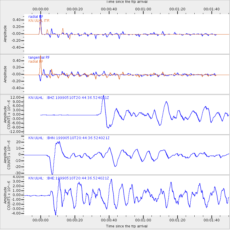
Earthquake location: New Britain Region, P.N.G.
Earthquake latitude/longitude: -5.2/150.9
Earthquake time(UTC): 1999/05/10 (130) 20:33:02 GMT
Earthquake Depth: 138 km
Earthquake Magnitude: 6.5 MB, 6.8 MS, 7.1 MW, 6.5 MB
Earthquake Catalog/Contributor: WHDF/NEIC
Network: KN Kyrgyz Seismic Telemetry Network
Station: ULHL KN.ULHL
Lat/Lon: 42.25 N/76.24 E
Elevation: 2040 m
Distance: 82.2 deg
Az: 313.722 deg
Baz: 104.202 deg
Ray Param: 0.046750315
Estimated Moho Depth: 63.75 km
Estimated Crust Vp/Vs: 1.63
Assumed Crust Vp: 6.306 km/s
Estimated Crust Vs: 3.869 km/s
Estimated Crust Poisson's Ratio: 0.20
Radial Match: 98.463936 %
Radial Bump: 219
Transverse Match: 93.44351 %
Transverse Bump: 400
SOD ConfigId: 4480
Insert Time: 2010-03-08 21:58:29.979 +0000
GWidth: 2.5
Max Bumps: 400
Tol: 0.001

Signal To Noise

ChannelStoNSTALTA
KN:ULHL: :BHN:19990510T20:44:36.524021Z8.3844246.779703E-78.086069E-8
KN:ULHL: :BHE:19990510T20:44:36.524021Z1.7790035.4313606E-83.0530362E-8
KN:ULHL: :BHZ:19990510T20:44:36.524021Z6.36145542.8085753E-74.414989E-8
Arrivals
Ps6.5 SECOND
PpPs26 SECOND
PsPs/PpSs32 SECOND