You are here: Home > Network List > TA - USArray Transportable Network (new EarthScope stations) Stations List
> Station H16K Elim, AK, USA > Earthquake Result Viewer
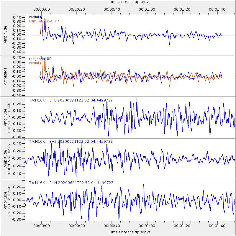
H16K Elim, AK, USA - Earthquake Result Viewer
*The percent match for this event was below the threshold and hence no stack was calculated.
| Earthquake location: |
Myanmar-India Border Region |
| Earthquake latitude/longitude: |
23.1/93.3 |
| Earthquake time(UTC): |
2020/06/21 (173) 22:40:52 GMT |
| Earthquake Depth: |
13 km |
| Earthquake Magnitude: |
5.6 Mww |
| Earthquake Catalog/Contributor: |
NEIC PDE/us |
|
| Network: |
TA USArray Transportable Network (new EarthScope stations) |
| Station: |
H16K Elim, AK, USA |
| Lat/Lon: |
64.64 N/162.24 W |
| Elevation: |
216 m |
|
| Distance: |
75.3 deg |
| Az: |
25.533 deg |
| Baz: |
292.88 deg |
| Ray Param: |
$rayparam |
*The percent match for this event was below the threshold and hence was not used in the summary stack. |
|
| Radial Match: |
72.28515 % |
| Radial Bump: |
400 |
| Transverse Match: |
57.29085 % |
| Transverse Bump: |
400 |
| SOD ConfigId: |
21709731 |
| Insert Time: |
2020-07-05 22:50:50.969 +0000 |
| GWidth: |
2.5 |
| Max Bumps: |
400 |
| Tol: |
0.001 |
|
Signal To Noise
| Channel | StoN | STA | LTA |
| TA:H16K: :BHZ:20200621T22:52:04.449972Z | 3.3965504 | 1.6158164E-7 | 4.7572275E-8 |
| TA:H16K: :BHN:20200621T22:52:04.449972Z | 1.3562095 | 5.4306636E-8 | 4.0042956E-8 |
| TA:H16K: :BHE:20200621T22:52:04.449972Z | 1.3630989 | 7.650925E-8 | 5.6128908E-8 |
| Arrivals |
| Ps | |
| PpPs | |
| PsPs/PpSs | |


