You are here: Home > Network List > IU - Global Seismograph Network (GSN - IRIS/USGS) Stations List
> Station PMG Port Moresby, New Guinea > Earthquake Result Viewer
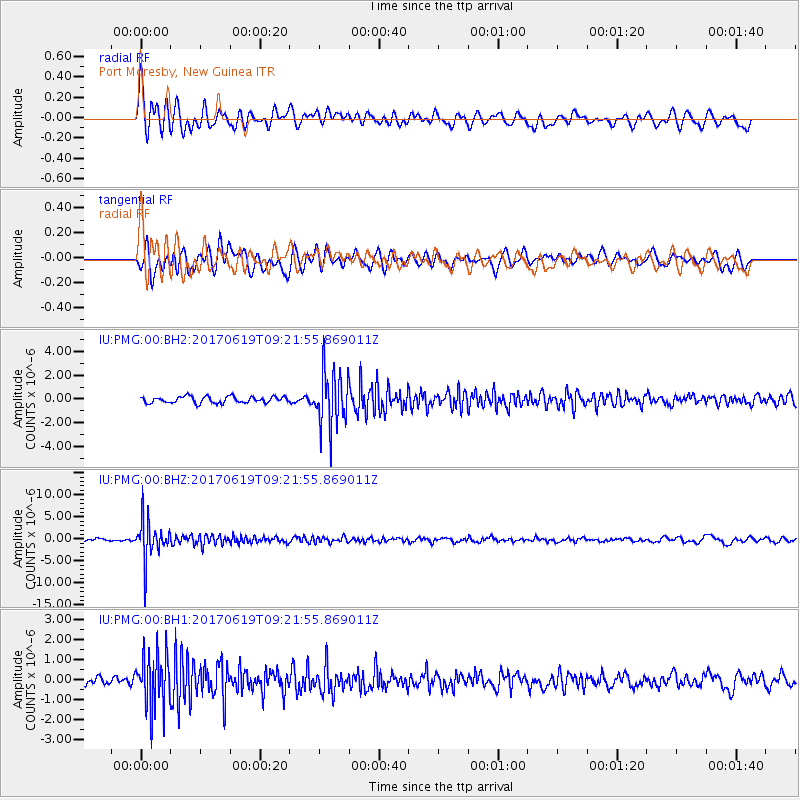
PMG Port Moresby, New Guinea - Earthquake Result Viewer
*The percent match for this event was below the threshold and hence no stack was calculated.
| Earthquake location: |
Fiji Islands Region |
| Earthquake latitude/longitude: |
-20.7/-176.5 |
| Earthquake time(UTC): |
2017/06/19 (170) 09:15:43 GMT |
| Earthquake Depth: |
264 km |
| Earthquake Magnitude: |
5.8 Mww |
| Earthquake Catalog/Contributor: |
NEIC PDE/us |
|
| Network: |
IU Global Seismograph Network (GSN - IRIS/USGS) |
| Station: |
PMG Port Moresby, New Guinea |
| Lat/Lon: |
9.40 S/147.16 E |
| Elevation: |
90 m |
|
| Distance: |
36.8 deg |
| Az: |
282.309 deg |
| Baz: |
112.056 deg |
| Ray Param: |
$rayparam |
*The percent match for this event was below the threshold and hence was not used in the summary stack. |
|
| Radial Match: |
75.75873 % |
| Radial Bump: |
400 |
| Transverse Match: |
69.68099 % |
| Transverse Bump: |
400 |
| SOD ConfigId: |
2140511 |
| Insert Time: |
2017-07-03 01:09:08.615 +0000 |
| GWidth: |
2.5 |
| Max Bumps: |
400 |
| Tol: |
0.001 |
|
Signal To Noise
| Channel | StoN | STA | LTA |
| IU:PMG:00:BHZ:20170619T09:21:55.869011Z | 21.577972 | 4.6005894E-6 | 2.1320768E-7 |
| IU:PMG:00:BH1:20170619T09:21:55.869011Z | 8.509718 | 1.336625E-6 | 1.5707042E-7 |
| IU:PMG:00:BH2:20170619T09:21:55.869011Z | 8.741414 | 2.3477469E-6 | 2.6857748E-7 |
| Arrivals |
| Ps | |
| PpPs | |
| PsPs/PpSs | |


