You are here: Home > Network List > IU - Global Seismograph Network (GSN - IRIS/USGS) Stations List
> Station RSSD Black Hills, South Dakota, USA > Earthquake Result Viewer
RSSD Black Hills, South Dakota, USA - Earthquake Result Viewer
*The percent match for this event was below the threshold and hence no stack was calculated.
| Earthquake location: |
Fiji Islands Region |
| Earthquake latitude/longitude: |
-20.7/-176.5 |
| Earthquake time(UTC): |
2017/06/19 (170) 09:15:43 GMT |
| Earthquake Depth: |
264 km |
| Earthquake Magnitude: |
5.8 Mww |
| Earthquake Catalog/Contributor: |
NEIC PDE/us |
|
| Network: |
IU Global Seismograph Network (GSN - IRIS/USGS) |
| Station: |
RSSD Black Hills, South Dakota, USA |
| Lat/Lon: |
44.12 N/104.04 W |
| Elevation: |
2090 m |
|
| Distance: |
92.3 deg |
| Az: |
43.41 deg |
| Baz: |
243.274 deg |
| Ray Param: |
$rayparam |
*The percent match for this event was below the threshold and hence was not used in the summary stack. |
|
| Radial Match: |
73.74502 % |
| Radial Bump: |
400 |
| Transverse Match: |
60.7432 % |
| Transverse Bump: |
391 |
| SOD ConfigId: |
2140511 |
| Insert Time: |
2017-07-03 01:09:12.801 +0000 |
| GWidth: |
2.5 |
| Max Bumps: |
400 |
| Tol: |
0.001 |
|
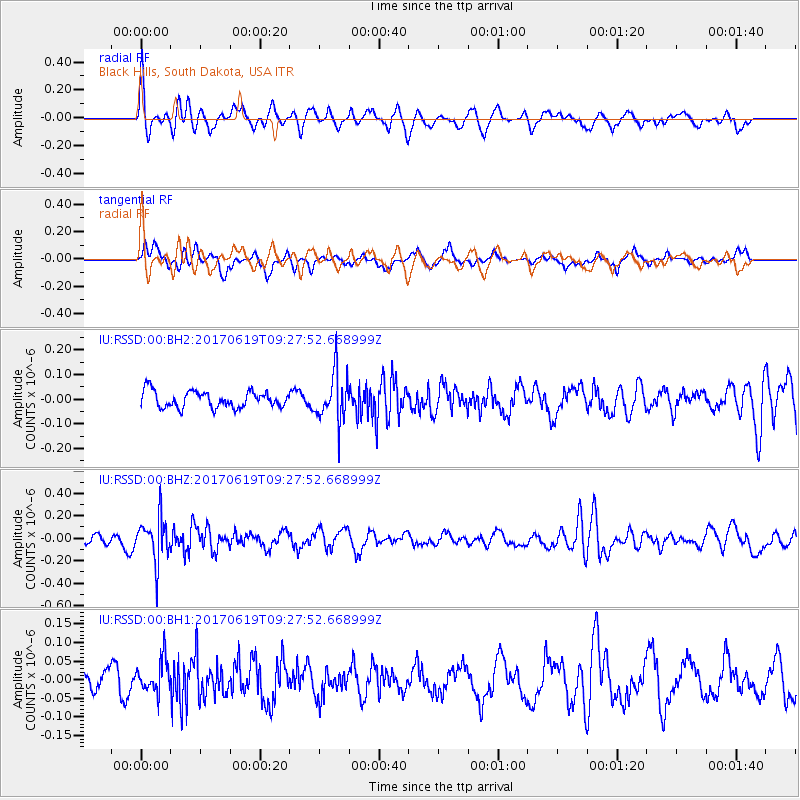
Signal To Noise
| Channel | StoN | STA | LTA |
| IU:RSSD:00:BHZ:20170619T09:27:52.668999Z | 3.1123877 | 1.87876E-7 | 6.0363945E-8 |
| IU:RSSD:00:BH1:20170619T09:27:52.668999Z | 1.0701777 | 4.3923748E-8 | 4.1043418E-8 |
| IU:RSSD:00:BH2:20170619T09:27:52.668999Z | 2.9926548 | 9.9412375E-8 | 3.3218793E-8 |
| Arrivals |
| Ps | |
| PpPs | |
| PsPs/PpSs | |


