You are here: Home > Network List > AV - Alaska Volcano Observatory Stations List
> Station PLBL Mt. Peulik Volcano, Alaska > Earthquake Result Viewer
PLBL Mt. Peulik Volcano, Alaska - Earthquake Result Viewer
*The percent match for this event was below the threshold and hence no stack was calculated.
| Earthquake location: |
Minahassa Peninsula, Sulawesi |
| Earthquake latitude/longitude: |
0.1/123.8 |
| Earthquake time(UTC): |
2020/06/23 (175) 07:43:28 GMT |
| Earthquake Depth: |
102 km |
| Earthquake Magnitude: |
5.9 mww |
| Earthquake Catalog/Contributor: |
NEIC PDE/us |
|
| Network: |
AV Alaska Volcano Observatory |
| Station: |
PLBL Mt. Peulik Volcano, Alaska |
| Lat/Lon: |
57.70 N/156.82 W |
| Elevation: |
461 m |
|
| Distance: |
84.3 deg |
| Az: |
32.031 deg |
| Baz: |
261.043 deg |
| Ray Param: |
$rayparam |
*The percent match for this event was below the threshold and hence was not used in the summary stack. |
|
| Radial Match: |
74.50016 % |
| Radial Bump: |
400 |
| Transverse Match: |
70.609146 % |
| Transverse Bump: |
400 |
| SOD ConfigId: |
21709731 |
| Insert Time: |
2020-07-07 07:49:19.868 +0000 |
| GWidth: |
2.5 |
| Max Bumps: |
400 |
| Tol: |
0.001 |
|
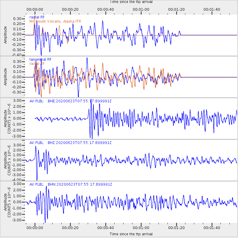
Signal To Noise
| Channel | StoN | STA | LTA |
| AV:PLBL: :BHZ:20200623T07:55:17.899991Z | 10.575186 | 1.4844718E-6 | 1.4037312E-7 |
| AV:PLBL: :BHN:20200623T07:55:17.899991Z | 4.650228 | 1.0250426E-6 | 2.2042845E-7 |
| AV:PLBL: :BHE:20200623T07:55:17.899991Z | 9.314537 | 1.5971331E-6 | 1.7146672E-7 |
| Arrivals |
| Ps | |
| PpPs | |
| PsPs/PpSs | |


