ULHL KN.ULHL - Earthquake Result Viewer
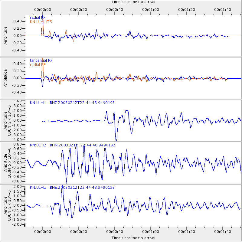
Earthquake location: Near N Coast Of New Guinea, P.N.G.
Earthquake latitude/longitude: -3.7/144.2
Earthquake time(UTC): 2003/02/12 (043) 22:33:30 GMT
Earthquake Depth: 10 km
Earthquake Magnitude: 6.0 MB, 6.1 MS, 6.2 MW, 6.2 MW
Earthquake Catalog/Contributor: WHDF/NEIC
Network: KN Kyrgyz Seismic Telemetry Network
Station: ULHL KN.ULHL
Lat/Lon: 42.25 N/76.24 E
Elevation: 2040 m
Distance: 76.4 deg
Az: 314.902 deg
Baz: 107.817 deg
Ray Param: 0.051022377
Estimated Moho Depth: 64.0 km
Estimated Crust Vp/Vs: 1.63
Assumed Crust Vp: 6.306 km/s
Estimated Crust Vs: 3.863 km/s
Estimated Crust Poisson's Ratio: 0.20
Radial Match: 93.97178 %
Radial Bump: 275
Transverse Match: 79.3955 %
Transverse Bump: 390
SOD ConfigId: 4714
Insert Time: 2010-03-08 22:00:15.773 +0000
GWidth: 2.5
Max Bumps: 400
Tol: 0.001

Signal To Noise

ChannelStoNSTALTA
KN:ULHL: :BHN:20030212T22:44:48.949019Z0.803829251.0291134E-71.2802637E-7
KN:ULHL: :BHE:20030212T22:44:48.949019Z0.455595674.0823863E-88.9605464E-8
KN:ULHL: :BHZ:20030212T22:44:48.949019Z1.25172631.18005126E-79.42739E-8
Arrivals
Ps6.6 SECOND
PpPs26 SECOND
PsPs/PpSs32 SECOND