ULHL KN.ULHL - Earthquake Result Viewer
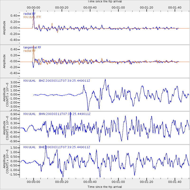
Earthquake location: New Ireland Region, P.N.G.
Earthquake latitude/longitude: -4.7/153.2
Earthquake time(UTC): 2003/03/11 (070) 07:27:32 GMT
Earthquake Depth: 40 km
Earthquake Magnitude: 6.0 MB, 6.8 MS, 6.8 MW, 6.6 MW
Earthquake Catalog/Contributor: WHDF/NEIC
Network: KN Kyrgyz Seismic Telemetry Network
Station: ULHL KN.ULHL
Lat/Lon: 42.25 N/76.24 E
Elevation: 2040 m
Distance: 83.6 deg
Az: 313.276 deg
Baz: 102.235 deg
Ray Param: 0.046035953
Estimated Moho Depth: 31.0 km
Estimated Crust Vp/Vs: 1.73
Assumed Crust Vp: 6.306 km/s
Estimated Crust Vs: 3.64 km/s
Estimated Crust Poisson's Ratio: 0.25
Radial Match: 94.24345 %
Radial Bump: 400
Transverse Match: 83.524376 %
Transverse Bump: 400
SOD ConfigId: 4714
Insert Time: 2010-03-08 22:00:38.603 +0000
GWidth: 2.5
Max Bumps: 400
Tol: 0.001

Signal To Noise

ChannelStoNSTALTA
KN:ULHL: :BHN:20030311T07:39:25.449011Z1.2433811.0246484E-78.240824E-8
KN:ULHL: :BHE:20030311T07:39:25.449011Z2.53836972.3207592E-79.1427154E-8
KN:ULHL: :BHZ:20030311T07:39:25.449011Z2.54512622.6348457E-71.03525146E-7
Arrivals
Ps3.7 SECOND
PpPs13 SECOND
PsPs/PpSs17 SECOND