You are here: Home > Network List > US - United States National Seismic Network Stations List
> Station EGMT Eagleton, Montana, USA > Earthquake Result Viewer
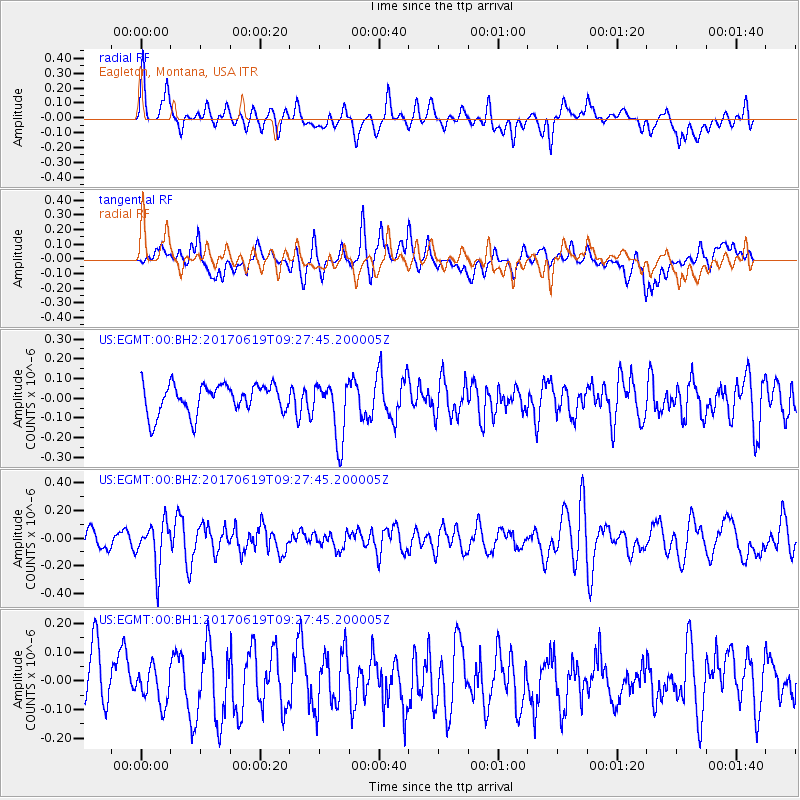
EGMT Eagleton, Montana, USA - Earthquake Result Viewer
*The percent match for this event was below the threshold and hence no stack was calculated.
| Earthquake location: |
Fiji Islands Region |
| Earthquake latitude/longitude: |
-20.7/-176.5 |
| Earthquake time(UTC): |
2017/06/19 (170) 09:15:43 GMT |
| Earthquake Depth: |
264 km |
| Earthquake Magnitude: |
5.8 Mww |
| Earthquake Catalog/Contributor: |
NEIC PDE/us |
|
| Network: |
US United States National Seismic Network |
| Station: |
EGMT Eagleton, Montana, USA |
| Lat/Lon: |
48.02 N/109.75 W |
| Elevation: |
1055 m |
|
| Distance: |
90.7 deg |
| Az: |
38.076 deg |
| Baz: |
239.307 deg |
| Ray Param: |
$rayparam |
*The percent match for this event was below the threshold and hence was not used in the summary stack. |
|
| Radial Match: |
52.916695 % |
| Radial Bump: |
400 |
| Transverse Match: |
52.59762 % |
| Transverse Bump: |
400 |
| SOD ConfigId: |
2140511 |
| Insert Time: |
2017-07-03 01:10:05.932 +0000 |
| GWidth: |
2.5 |
| Max Bumps: |
400 |
| Tol: |
0.001 |
|
Signal To Noise
| Channel | StoN | STA | LTA |
| US:EGMT:00:BHZ:20170619T09:27:45.200005Z | 2.2821248 | 1.5954187E-7 | 6.9909355E-8 |
| US:EGMT:00:BH1:20170619T09:27:45.200005Z | 0.7416715 | 5.940363E-8 | 8.009426E-8 |
| US:EGMT:00:BH2:20170619T09:27:45.200005Z | 2.000458 | 1.4903745E-7 | 7.450166E-8 |
| Arrivals |
| Ps | |
| PpPs | |
| PsPs/PpSs | |


