You are here: Home > Network List > TA - USArray Transportable Network (new EarthScope stations) Stations List
> Station G21K Allakaket, AK, USA > Earthquake Result Viewer
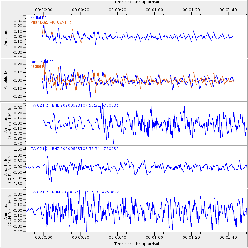
G21K Allakaket, AK, USA - Earthquake Result Viewer
*The percent match for this event was below the threshold and hence no stack was calculated.
| Earthquake location: |
Minahassa Peninsula, Sulawesi |
| Earthquake latitude/longitude: |
0.1/123.8 |
| Earthquake time(UTC): |
2020/06/23 (175) 07:43:28 GMT |
| Earthquake Depth: |
102 km |
| Earthquake Magnitude: |
5.9 mww |
| Earthquake Catalog/Contributor: |
NEIC PDE/us |
|
| Network: |
TA USArray Transportable Network (new EarthScope stations) |
| Station: |
G21K Allakaket, AK, USA |
| Lat/Lon: |
66.52 N/153.51 W |
| Elevation: |
446 m |
|
| Distance: |
87.0 deg |
| Az: |
23.456 deg |
| Baz: |
263.326 deg |
| Ray Param: |
$rayparam |
*The percent match for this event was below the threshold and hence was not used in the summary stack. |
|
| Radial Match: |
68.29254 % |
| Radial Bump: |
400 |
| Transverse Match: |
69.2274 % |
| Transverse Bump: |
400 |
| SOD ConfigId: |
21709731 |
| Insert Time: |
2020-07-07 07:56:10.888 +0000 |
| GWidth: |
2.5 |
| Max Bumps: |
400 |
| Tol: |
0.001 |
|
Signal To Noise
| Channel | StoN | STA | LTA |
| TA:G21K: :BHZ:20200623T07:55:31.475003Z | 12.210191 | 7.5501094E-7 | 6.18345E-8 |
| TA:G21K: :BHN:20200623T07:55:31.475003Z | 1.896098 | 1.2470717E-7 | 6.577043E-8 |
| TA:G21K: :BHE:20200623T07:55:31.475003Z | 2.3509035 | 1.818936E-7 | 7.737178E-8 |
| Arrivals |
| Ps | |
| PpPs | |
| PsPs/PpSs | |


