You are here: Home > Network List > US - United States National Seismic Network Stations List
> Station HAWA Hanford, Washington, USA > Earthquake Result Viewer
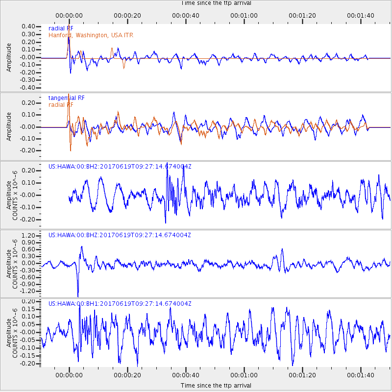
HAWA Hanford, Washington, USA - Earthquake Result Viewer
*The percent match for this event was below the threshold and hence no stack was calculated.
| Earthquake location: |
Fiji Islands Region |
| Earthquake latitude/longitude: |
-20.7/-176.5 |
| Earthquake time(UTC): |
2017/06/19 (170) 09:15:43 GMT |
| Earthquake Depth: |
264 km |
| Earthquake Magnitude: |
5.8 Mww |
| Earthquake Catalog/Contributor: |
NEIC PDE/us |
|
| Network: |
US United States National Seismic Network |
| Station: |
HAWA Hanford, Washington, USA |
| Lat/Lon: |
46.39 N/119.53 W |
| Elevation: |
364 m |
|
| Distance: |
84.3 deg |
| Az: |
35.662 deg |
| Baz: |
232.04 deg |
| Ray Param: |
$rayparam |
*The percent match for this event was below the threshold and hence was not used in the summary stack. |
|
| Radial Match: |
66.73883 % |
| Radial Bump: |
400 |
| Transverse Match: |
61.79744 % |
| Transverse Bump: |
377 |
| SOD ConfigId: |
2140511 |
| Insert Time: |
2017-07-03 01:10:08.595 +0000 |
| GWidth: |
2.5 |
| Max Bumps: |
400 |
| Tol: |
0.001 |
|
Signal To Noise
| Channel | StoN | STA | LTA |
| US:HAWA:00:BHZ:20170619T09:27:14.674004Z | 6.299558 | 4.3114406E-7 | 6.844037E-8 |
| US:HAWA:00:BH1:20170619T09:27:14.674004Z | 1.6192721 | 8.378763E-8 | 5.1744006E-8 |
| US:HAWA:00:BH2:20170619T09:27:14.674004Z | 1.3161147 | 9.147546E-8 | 6.950417E-8 |
| Arrivals |
| Ps | |
| PpPs | |
| PsPs/PpSs | |


