You are here: Home > Network List > TA - USArray Transportable Network (new EarthScope stations) Stations List
> Station H16K Elim, AK, USA > Earthquake Result Viewer
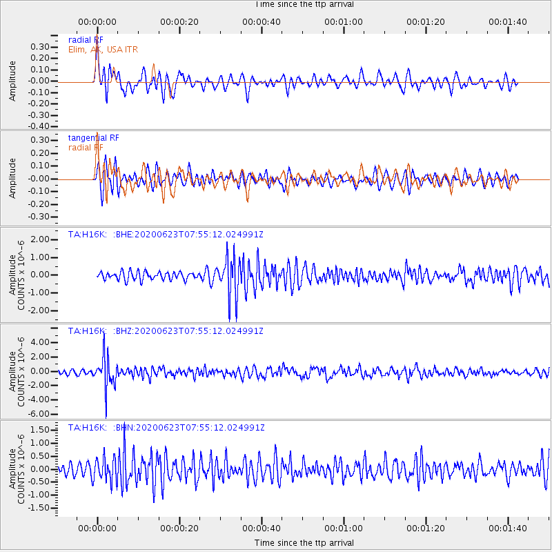
H16K Elim, AK, USA - Earthquake Result Viewer
*The percent match for this event was below the threshold and hence no stack was calculated.
| Earthquake location: |
Minahassa Peninsula, Sulawesi |
| Earthquake latitude/longitude: |
0.1/123.8 |
| Earthquake time(UTC): |
2020/06/23 (175) 07:43:28 GMT |
| Earthquake Depth: |
102 km |
| Earthquake Magnitude: |
5.9 mww |
| Earthquake Catalog/Contributor: |
NEIC PDE/us |
|
| Network: |
TA USArray Transportable Network (new EarthScope stations) |
| Station: |
H16K Elim, AK, USA |
| Lat/Lon: |
64.64 N/162.24 W |
| Elevation: |
216 m |
|
| Distance: |
83.1 deg |
| Az: |
24.641 deg |
| Baz: |
255.481 deg |
| Ray Param: |
$rayparam |
*The percent match for this event was below the threshold and hence was not used in the summary stack. |
|
| Radial Match: |
57.984814 % |
| Radial Bump: |
400 |
| Transverse Match: |
60.13451 % |
| Transverse Bump: |
400 |
| SOD ConfigId: |
21709731 |
| Insert Time: |
2020-07-07 07:56:22.314 +0000 |
| GWidth: |
2.5 |
| Max Bumps: |
400 |
| Tol: |
0.001 |
|
Signal To Noise
| Channel | StoN | STA | LTA |
| TA:H16K: :BHZ:20200623T07:55:12.024991Z | 10.563927 | 2.169021E-6 | 2.0532336E-7 |
| TA:H16K: :BHN:20200623T07:55:12.024991Z | 1.5963049 | 4.364084E-7 | 2.7338663E-7 |
| TA:H16K: :BHE:20200623T07:55:12.024991Z | 5.091825 | 1.102059E-6 | 2.1643692E-7 |
| Arrivals |
| Ps | |
| PpPs | |
| PsPs/PpSs | |


