You are here: Home > Network List > TA - USArray Transportable Network (new EarthScope stations) Stations List
> Station M11K Mekoryuk, AK, USA > Earthquake Result Viewer
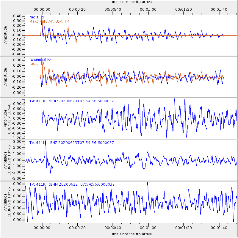
M11K Mekoryuk, AK, USA - Earthquake Result Viewer
*The percent match for this event was below the threshold and hence no stack was calculated.
| Earthquake location: |
Minahassa Peninsula, Sulawesi |
| Earthquake latitude/longitude: |
0.1/123.8 |
| Earthquake time(UTC): |
2020/06/23 (175) 07:43:28 GMT |
| Earthquake Depth: |
102 km |
| Earthquake Magnitude: |
5.9 mww |
| Earthquake Catalog/Contributor: |
NEIC PDE/us |
|
| Network: |
TA USArray Transportable Network (new EarthScope stations) |
| Station: |
M11K Mekoryuk, AK, USA |
| Lat/Lon: |
60.38 N/166.20 W |
| Elevation: |
3.0 m |
|
| Distance: |
80.2 deg |
| Az: |
28.274 deg |
| Baz: |
252.497 deg |
| Ray Param: |
$rayparam |
*The percent match for this event was below the threshold and hence was not used in the summary stack. |
|
| Radial Match: |
55.8164 % |
| Radial Bump: |
400 |
| Transverse Match: |
55.18567 % |
| Transverse Bump: |
400 |
| SOD ConfigId: |
21709731 |
| Insert Time: |
2020-07-07 07:56:58.218 +0000 |
| GWidth: |
2.5 |
| Max Bumps: |
400 |
| Tol: |
0.001 |
|
Signal To Noise
| Channel | StoN | STA | LTA |
| TA:M11K: :BHZ:20200623T07:54:56.600003Z | 4.276058 | 1.1008192E-6 | 2.5743782E-7 |
| TA:M11K: :BHN:20200623T07:54:56.600003Z | 1.0048902 | 3.5231224E-7 | 3.5059776E-7 |
| TA:M11K: :BHE:20200623T07:54:56.600003Z | 1.4337415 | 3.4522782E-7 | 2.4078807E-7 |
| Arrivals |
| Ps | |
| PpPs | |
| PsPs/PpSs | |


