You are here: Home > Network List > US - United States National Seismic Network Stations List
> Station MSO Missoula, Montana, USA > Earthquake Result Viewer
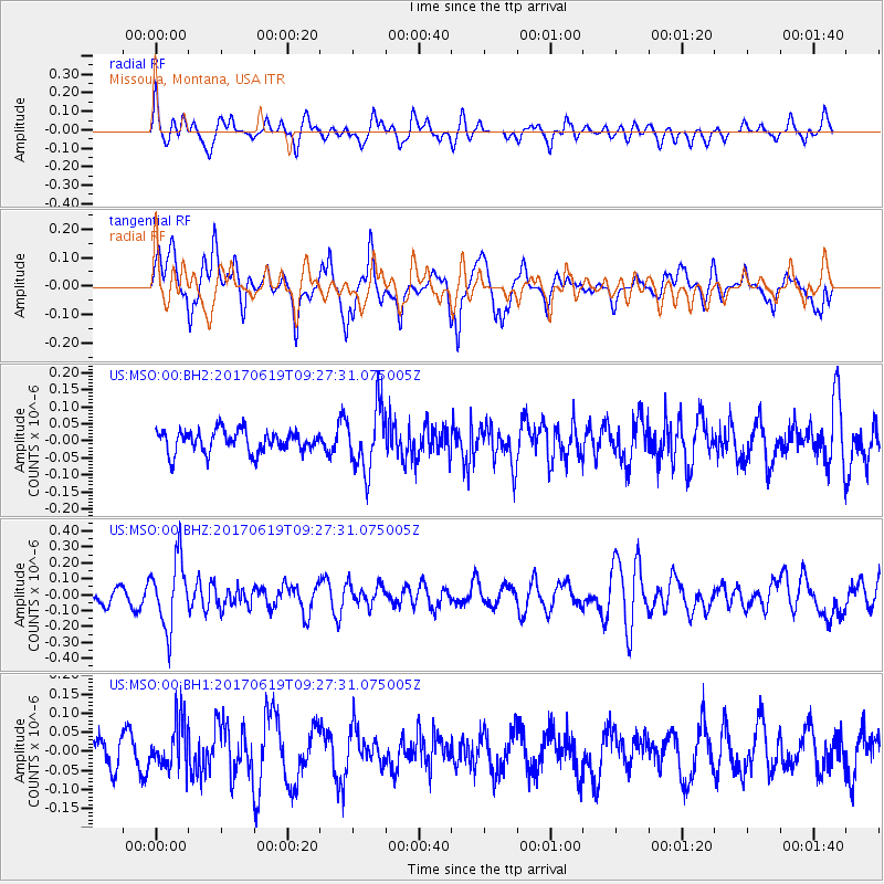
MSO Missoula, Montana, USA - Earthquake Result Viewer
*The percent match for this event was below the threshold and hence no stack was calculated.
| Earthquake location: |
Fiji Islands Region |
| Earthquake latitude/longitude: |
-20.7/-176.5 |
| Earthquake time(UTC): |
2017/06/19 (170) 09:15:43 GMT |
| Earthquake Depth: |
264 km |
| Earthquake Magnitude: |
5.8 Mww |
| Earthquake Catalog/Contributor: |
NEIC PDE/us |
|
| Network: |
US United States National Seismic Network |
| Station: |
MSO Missoula, Montana, USA |
| Lat/Lon: |
46.83 N/113.94 W |
| Elevation: |
1264 m |
|
| Distance: |
87.7 deg |
| Az: |
37.571 deg |
| Baz: |
236.226 deg |
| Ray Param: |
$rayparam |
*The percent match for this event was below the threshold and hence was not used in the summary stack. |
|
| Radial Match: |
53.07966 % |
| Radial Bump: |
400 |
| Transverse Match: |
52.263863 % |
| Transverse Bump: |
400 |
| SOD ConfigId: |
2140511 |
| Insert Time: |
2017-07-03 01:10:19.297 +0000 |
| GWidth: |
2.5 |
| Max Bumps: |
400 |
| Tol: |
0.001 |
|
Signal To Noise
| Channel | StoN | STA | LTA |
| US:MSO:00:BHZ:20170619T09:27:31.075005Z | 3.4111285 | 2.1165513E-7 | 6.204842E-8 |
| US:MSO:00:BH1:20170619T09:27:31.075005Z | 1.1733066 | 6.1377335E-8 | 5.2311425E-8 |
| US:MSO:00:BH2:20170619T09:27:31.075005Z | 2.8708713 | 9.099134E-8 | 3.169468E-8 |
| Arrivals |
| Ps | |
| PpPs | |
| PsPs/PpSs | |


