You are here: Home > Network List > TA - USArray Transportable Network (new EarthScope stations) Stations List
> Station R33M Jennings River, BC, CAN > Earthquake Result Viewer
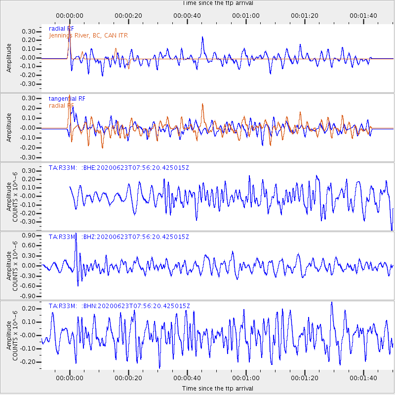
R33M Jennings River, BC, CAN - Earthquake Result Viewer
*The percent match for this event was below the threshold and hence no stack was calculated.
| Earthquake location: |
Minahassa Peninsula, Sulawesi |
| Earthquake latitude/longitude: |
0.1/123.8 |
| Earthquake time(UTC): |
2020/06/23 (175) 07:43:28 GMT |
| Earthquake Depth: |
102 km |
| Earthquake Magnitude: |
5.9 mww |
| Earthquake Catalog/Contributor: |
NEIC PDE/us |
|
| Network: |
TA USArray Transportable Network (new EarthScope stations) |
| Station: |
R33M Jennings River, BC, CAN |
| Lat/Lon: |
59.39 N/130.97 W |
| Elevation: |
1437 m |
|
| Distance: |
97.7 deg |
| Az: |
29.877 deg |
| Baz: |
283.199 deg |
| Ray Param: |
$rayparam |
*The percent match for this event was below the threshold and hence was not used in the summary stack. |
|
| Radial Match: |
63.799328 % |
| Radial Bump: |
400 |
| Transverse Match: |
53.849785 % |
| Transverse Bump: |
400 |
| SOD ConfigId: |
21709731 |
| Insert Time: |
2020-07-07 07:57:45.664 +0000 |
| GWidth: |
2.5 |
| Max Bumps: |
400 |
| Tol: |
0.001 |
|
Signal To Noise
| Channel | StoN | STA | LTA |
| TA:R33M: :BHZ:20200623T07:56:20.425015Z | 6.2902026 | 3.3429004E-7 | 5.3144557E-8 |
| TA:R33M: :BHN:20200623T07:56:20.425015Z | 1.300792 | 8.3562334E-8 | 6.4239586E-8 |
| TA:R33M: :BHE:20200623T07:56:20.425015Z | 1.3973005 | 1.0877868E-7 | 7.7849165E-8 |
| Arrivals |
| Ps | |
| PpPs | |
| PsPs/PpSs | |


