You are here: Home > Network List > KN - Kyrgyz Seismic Telemetry Network Stations List
> Station ULHL KN.ULHL > Earthquake Result Viewer
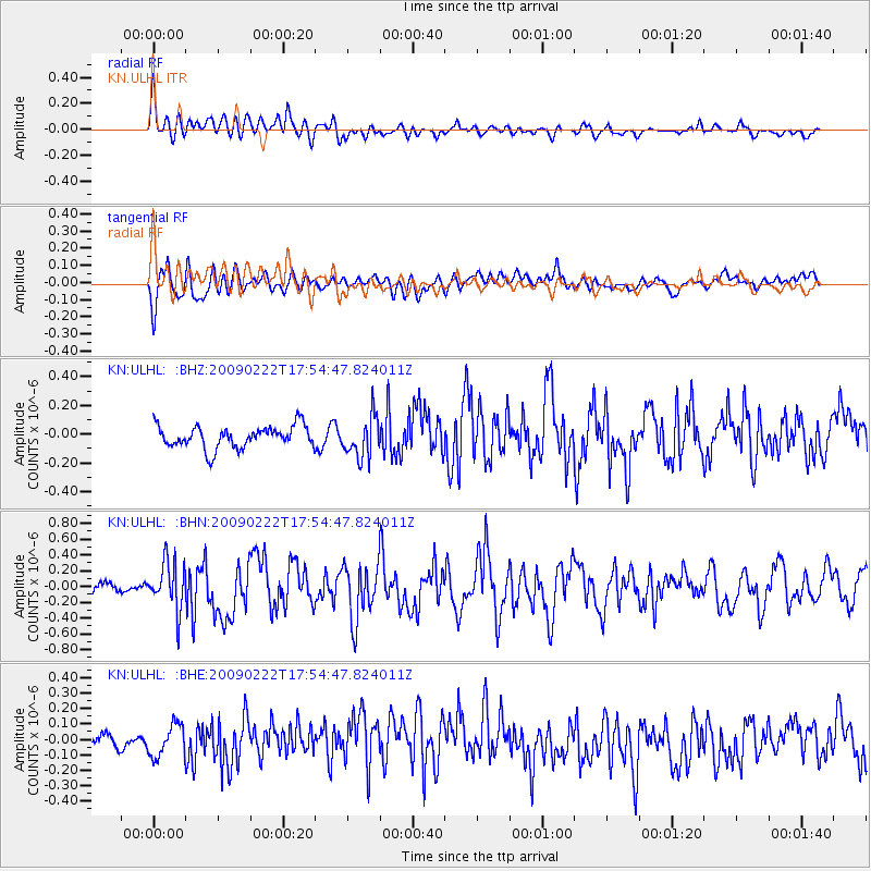
ULHL KN.ULHL - Earthquake Result Viewer
*The percent match for this event was below the threshold and hence no stack was calculated.
| Earthquake location: |
Talaud Islands, Indonesia |
| Earthquake latitude/longitude: |
3.7/126.6 |
| Earthquake time(UTC): |
2009/02/22 (053) 17:45:22 GMT |
| Earthquake Depth: |
32 km |
| Earthquake Magnitude: |
5.9 MB, 5.7 MS, 6.0 MW, 6.0 MW |
| Earthquake Catalog/Contributor: |
WHDF/NEIC |
|
| Network: |
KN Kyrgyz Seismic Telemetry Network |
| Station: |
ULHL KN.ULHL |
| Lat/Lon: |
42.25 N/76.24 E |
| Elevation: |
2040 m |
|
| Distance: |
58.9 deg |
| Az: |
318.161 deg |
| Baz: |
116.294 deg |
| Ray Param: |
$rayparam |
*The percent match for this event was below the threshold and hence was not used in the summary stack. |
|
| Radial Match: |
70.0962 % |
| Radial Bump: |
400 |
| Transverse Match: |
53.951202 % |
| Transverse Bump: |
400 |
| SOD ConfigId: |
2658 |
| Insert Time: |
2010-03-08 22:03:15.541 +0000 |
| GWidth: |
2.5 |
| Max Bumps: |
400 |
| Tol: |
0.001 |
|
Signal To Noise
| Channel | StoN | STA | LTA |
| KN:ULHL: :BHN:20090222T17:54:47.824011Z | 3.460397 | 2.9956044E-7 | 8.6568235E-8 |
| KN:ULHL: :BHE:20090222T17:54:47.824011Z | 0.9043404 | 1.0968218E-7 | 1.2128419E-7 |
| KN:ULHL: :BHZ:20090222T17:54:47.824011Z | 1.8405805 | 1.4089493E-7 | 7.6549185E-8 |
| Arrivals |
| Ps | |
| PpPs | |
| PsPs/PpSs | |


