You are here: Home > Network List > IU - Global Seismograph Network (GSN - IRIS/USGS) Stations List
> Station PMG Port Moresby, New Guinea > Earthquake Result Viewer
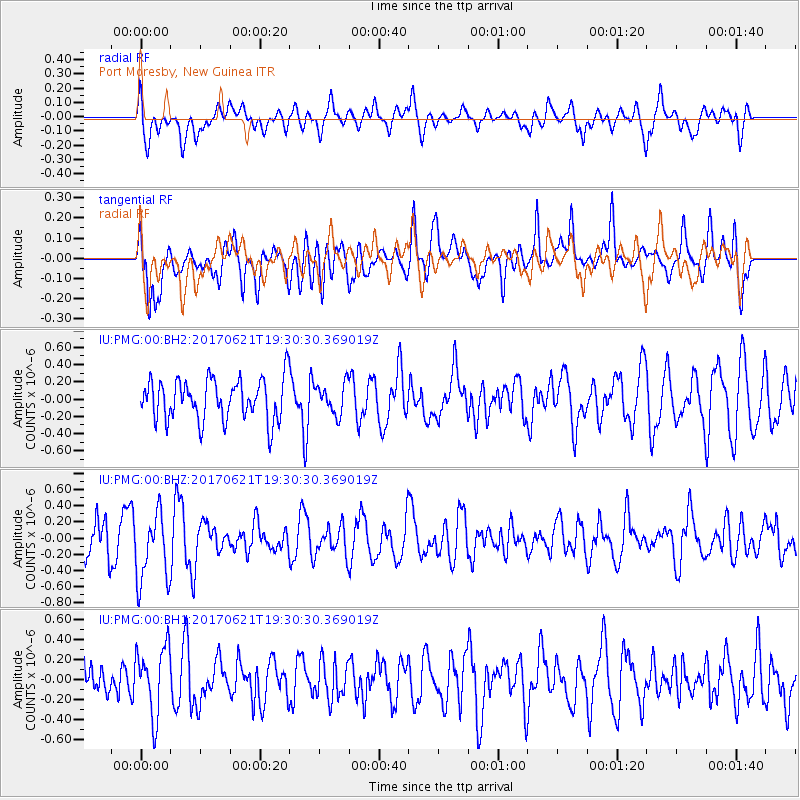
PMG Port Moresby, New Guinea - Earthquake Result Viewer
*The percent match for this event was below the threshold and hence no stack was calculated.
| Earthquake location: |
Rat Islands, Aleutian Islands |
| Earthquake latitude/longitude: |
51.8/179.4 |
| Earthquake time(UTC): |
2017/06/21 (172) 19:20:26 GMT |
| Earthquake Depth: |
165 km |
| Earthquake Magnitude: |
5.5 Mb |
| Earthquake Catalog/Contributor: |
NEIC PDE/at |
|
| Network: |
IU Global Seismograph Network (GSN - IRIS/USGS) |
| Station: |
PMG Port Moresby, New Guinea |
| Lat/Lon: |
9.40 S/147.16 E |
| Elevation: |
90 m |
|
| Distance: |
67.0 deg |
| Az: |
214.898 deg |
| Baz: |
21.086 deg |
| Ray Param: |
$rayparam |
*The percent match for this event was below the threshold and hence was not used in the summary stack. |
|
| Radial Match: |
44.825558 % |
| Radial Bump: |
400 |
| Transverse Match: |
64.43912 % |
| Transverse Bump: |
400 |
| SOD ConfigId: |
2140511 |
| Insert Time: |
2017-07-05 11:25:52.762 +0000 |
| GWidth: |
2.5 |
| Max Bumps: |
400 |
| Tol: |
0.001 |
|
Signal To Noise
| Channel | StoN | STA | LTA |
| IU:PMG:00:BHZ:20170621T19:30:30.369019Z | 2.0861073 | 4.3241246E-7 | 2.0728199E-7 |
| IU:PMG:00:BH1:20170621T19:30:30.369019Z | 1.6698498 | 3.451789E-7 | 2.0671256E-7 |
| IU:PMG:00:BH2:20170621T19:30:30.369019Z | 0.7265401 | 1.739094E-7 | 2.3936656E-7 |
| Arrivals |
| Ps | |
| PpPs | |
| PsPs/PpSs | |


