You are here: Home > Network List > KN - Kyrgyz Seismic Telemetry Network Stations List
> Station ULHL KN.ULHL > Earthquake Result Viewer
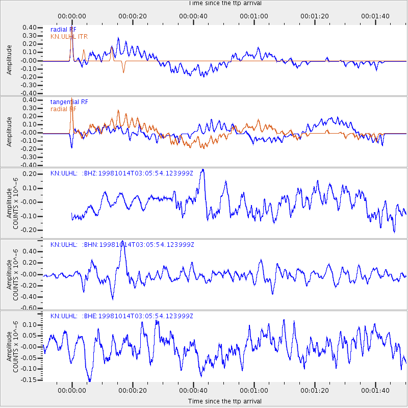
ULHL KN.ULHL - Earthquake Result Viewer
*The percent match for this event was below the threshold and hence no stack was calculated.
| Earthquake location: |
New Britain Region, P.N.G. |
| Earthquake latitude/longitude: |
-5.9/151.0 |
| Earthquake time(UTC): |
1998/10/14 (287) 02:54:04 GMT |
| Earthquake Depth: |
33 km |
| Earthquake Magnitude: |
5.5 MB, 5.7 MS, 6.0 UNKNOWN, 5.8 MW |
| Earthquake Catalog/Contributor: |
WHDF/NEIC |
|
| Network: |
KN Kyrgyz Seismic Telemetry Network |
| Station: |
ULHL KN.ULHL |
| Lat/Lon: |
42.25 N/76.24 E |
| Elevation: |
2040 m |
|
| Distance: |
82.8 deg |
| Az: |
313.764 deg |
| Baz: |
104.641 deg |
| Ray Param: |
$rayparam |
*The percent match for this event was below the threshold and hence was not used in the summary stack. |
|
| Radial Match: |
50.583946 % |
| Radial Bump: |
400 |
| Transverse Match: |
48.282097 % |
| Transverse Bump: |
400 |
| SOD ConfigId: |
4480 |
| Insert Time: |
2010-03-08 22:03:55.093 +0000 |
| GWidth: |
2.5 |
| Max Bumps: |
400 |
| Tol: |
0.001 |
|
Signal To Noise
| Channel | StoN | STA | LTA |
| KN:ULHL: :BHN:19981014T03:05:54.123999Z | 2.1415746 | 9.9173285E-8 | 4.6308585E-8 |
| KN:ULHL: :BHE:19981014T03:05:54.123999Z | 0.9105791 | 4.8994178E-8 | 5.3805515E-8 |
| KN:ULHL: :BHZ:19981014T03:05:54.123999Z | 1.0546569 | 5.7934884E-8 | 5.493245E-8 |
| Arrivals |
| Ps | |
| PpPs | |
| PsPs/PpSs | |


