You are here: Home > Network List > KN - Kyrgyz Seismic Telemetry Network Stations List
> Station ULHL KN.ULHL > Earthquake Result Viewer
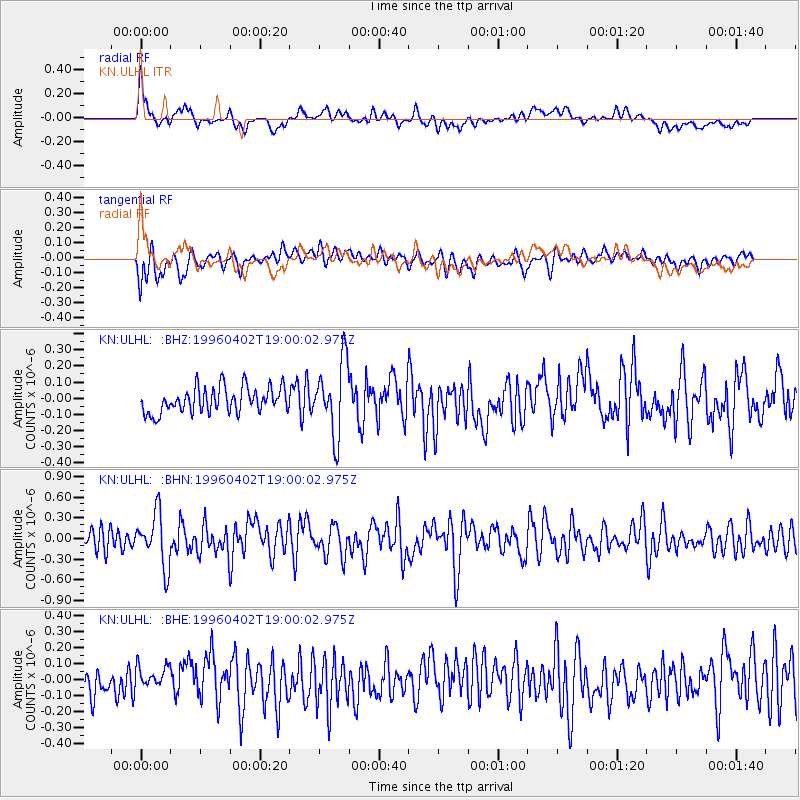
ULHL KN.ULHL - Earthquake Result Viewer
*The percent match for this event was below the threshold and hence no stack was calculated.
| Earthquake location: |
Talaud Islands, Indonesia |
| Earthquake latitude/longitude: |
3.1/126.3 |
| Earthquake time(UTC): |
1996/04/02 (093) 18:50:36 GMT |
| Earthquake Depth: |
41 km |
| Earthquake Magnitude: |
5.7 MB, 5.4 MS, 5.9 UNKNOWN, 5.6 MW |
| Earthquake Catalog/Contributor: |
WHDF/NEIC |
|
| Network: |
KN Kyrgyz Seismic Telemetry Network |
| Station: |
ULHL KN.ULHL |
| Lat/Lon: |
42.25 N/76.24 E |
| Elevation: |
2040 m |
|
| Distance: |
59.2 deg |
| Az: |
318.51 deg |
| Baz: |
117.006 deg |
| Ray Param: |
$rayparam |
*The percent match for this event was below the threshold and hence was not used in the summary stack. |
|
| Radial Match: |
68.43289 % |
| Radial Bump: |
400 |
| Transverse Match: |
60.37042 % |
| Transverse Bump: |
400 |
| SOD ConfigId: |
4480 |
| Insert Time: |
2010-03-08 22:03:58.562 +0000 |
| GWidth: |
2.5 |
| Max Bumps: |
400 |
| Tol: |
0.001 |
|
Signal To Noise
| Channel | StoN | STA | LTA |
| KN:ULHL: :BHN:19960402T19:00:02.975Z | 3.1030335 | 3.8429525E-7 | 1.2384501E-7 |
| KN:ULHL: :BHE:19960402T19:00:02.975Z | 1.0447538 | 7.7936015E-8 | 7.4597494E-8 |
| KN:ULHL: :BHZ:19960402T19:00:02.975Z | 2.870383 | 2.2492686E-7 | 7.836127E-8 |
| Arrivals |
| Ps | |
| PpPs | |
| PsPs/PpSs | |


