You are here: Home > Network List > US - United States National Seismic Network Stations List
> Station WMOK Wichita Mountains, Oklahoma, USA > Earthquake Result Viewer
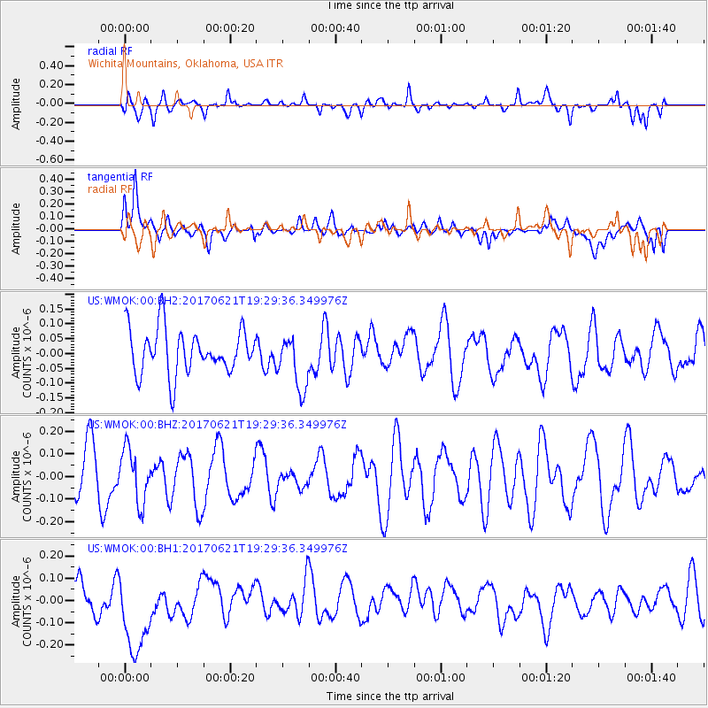
WMOK Wichita Mountains, Oklahoma, USA - Earthquake Result Viewer
*The percent match for this event was below the threshold and hence no stack was calculated.
| Earthquake location: |
Rat Islands, Aleutian Islands |
| Earthquake latitude/longitude: |
51.8/179.4 |
| Earthquake time(UTC): |
2017/06/21 (172) 19:20:26 GMT |
| Earthquake Depth: |
165 km |
| Earthquake Magnitude: |
5.5 Mb |
| Earthquake Catalog/Contributor: |
NEIC PDE/at |
|
| Network: |
US United States National Seismic Network |
| Station: |
WMOK Wichita Mountains, Oklahoma, USA |
| Lat/Lon: |
34.74 N/98.78 W |
| Elevation: |
486 m |
|
| Distance: |
58.8 deg |
| Az: |
72.319 deg |
| Baz: |
314.122 deg |
| Ray Param: |
$rayparam |
*The percent match for this event was below the threshold and hence was not used in the summary stack. |
|
| Radial Match: |
53.394775 % |
| Radial Bump: |
400 |
| Transverse Match: |
47.65782 % |
| Transverse Bump: |
400 |
| SOD ConfigId: |
2140511 |
| Insert Time: |
2017-07-05 11:32:00.947 +0000 |
| GWidth: |
2.5 |
| Max Bumps: |
400 |
| Tol: |
0.001 |
|
Signal To Noise
| Channel | StoN | STA | LTA |
| US:WMOK:00:BHZ:20170621T19:29:36.349976Z | 1.1356125 | 1.1898817E-7 | 1.0477885E-7 |
| US:WMOK:00:BH1:20170621T19:29:36.349976Z | 2.4316304 | 2.1038746E-7 | 8.652115E-8 |
| US:WMOK:00:BH2:20170621T19:29:36.349976Z | 1.22835 | 9.380325E-8 | 7.636524E-8 |
| Arrivals |
| Ps | |
| PpPs | |
| PsPs/PpSs | |


