You are here: Home > Network List > UU - University of Utah Regional Network Stations List
> Station FOR4 Blundell West, UT, USA > Earthquake Result Viewer
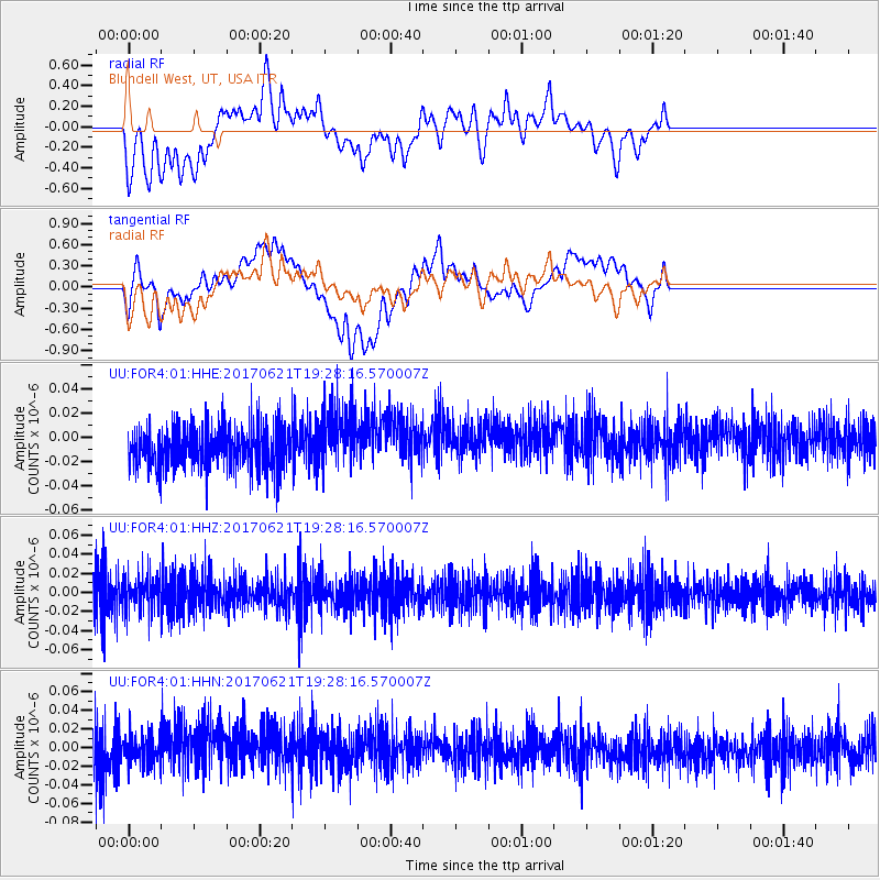
FOR4 Blundell West, UT, USA - Earthquake Result Viewer
*The percent match for this event was below the threshold and hence no stack was calculated.
| Earthquake location: |
Rat Islands, Aleutian Islands |
| Earthquake latitude/longitude: |
51.8/179.4 |
| Earthquake time(UTC): |
2017/06/21 (172) 19:20:26 GMT |
| Earthquake Depth: |
165 km |
| Earthquake Magnitude: |
5.5 Mb |
| Earthquake Catalog/Contributor: |
NEIC PDE/at |
|
| Network: |
UU University of Utah Regional Network |
| Station: |
FOR4 Blundell West, UT, USA |
| Lat/Lon: |
38.50 N/112.90 W |
| Elevation: |
1657 m |
|
| Distance: |
47.9 deg |
| Az: |
78.248 deg |
| Baz: |
309.265 deg |
| Ray Param: |
$rayparam |
*The percent match for this event was below the threshold and hence was not used in the summary stack. |
|
| Radial Match: |
57.12157 % |
| Radial Bump: |
400 |
| Transverse Match: |
37.19523 % |
| Transverse Bump: |
400 |
| SOD ConfigId: |
2140511 |
| Insert Time: |
2017-07-05 11:33:14.475 +0000 |
| GWidth: |
2.5 |
| Max Bumps: |
400 |
| Tol: |
0.001 |
|
Signal To Noise
| Channel | StoN | STA | LTA |
| UU:FOR4:01:HHZ:20170621T19:28:16.570007Z | 1.0476874 | 1.9211626E-8 | 1.8337174E-8 |
| UU:FOR4:01:HHN:20170621T19:28:16.570007Z | 0.7172867 | 1.6550471E-8 | 2.3073719E-8 |
| UU:FOR4:01:HHE:20170621T19:28:16.570007Z | 1.4619707 | 2.6119498E-8 | 1.7865952E-8 |
| Arrivals |
| Ps | |
| PpPs | |
| PsPs/PpSs | |


