You are here: Home > Network List > TA - USArray Transportable Network (new EarthScope stations) Stations List
> Station G31M Satah River, YT, CAN > Earthquake Result Viewer
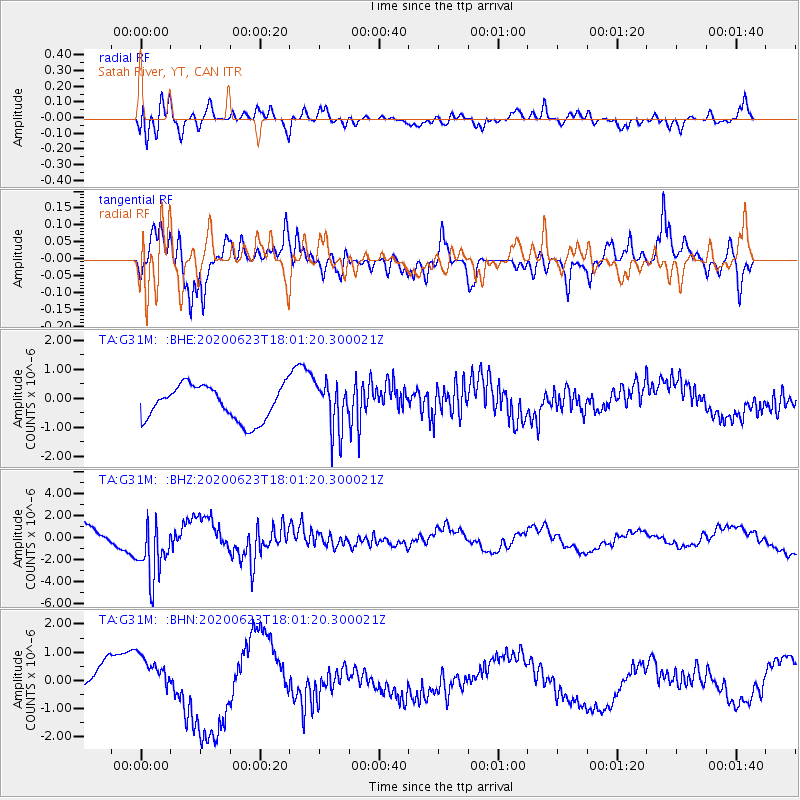
G31M Satah River, YT, CAN - Earthquake Result Viewer
*The percent match for this event was below the threshold and hence no stack was calculated.
| Earthquake location: |
Mariana Islands |
| Earthquake latitude/longitude: |
14.0/145.5 |
| Earthquake time(UTC): |
2020/06/23 (175) 17:50:26 GMT |
| Earthquake Depth: |
68 km |
| Earthquake Magnitude: |
5.9 mb |
| Earthquake Catalog/Contributor: |
NEIC PDE/us |
|
| Network: |
TA USArray Transportable Network (new EarthScope stations) |
| Station: |
G31M Satah River, YT, CAN |
| Lat/Lon: |
66.92 N/134.27 W |
| Elevation: |
61 m |
|
| Distance: |
73.4 deg |
| Az: |
23.916 deg |
| Baz: |
266.58 deg |
| Ray Param: |
$rayparam |
*The percent match for this event was below the threshold and hence was not used in the summary stack. |
|
| Radial Match: |
41.48189 % |
| Radial Bump: |
400 |
| Transverse Match: |
78.11831 % |
| Transverse Bump: |
400 |
| SOD ConfigId: |
21709731 |
| Insert Time: |
2020-07-07 18:01:52.576 +0000 |
| GWidth: |
2.5 |
| Max Bumps: |
400 |
| Tol: |
0.001 |
|
Signal To Noise
| Channel | StoN | STA | LTA |
| TA:G31M: :BHZ:20200623T18:01:20.300021Z | 2.199542 | 2.7213716E-6 | 1.2372448E-6 |
| TA:G31M: :BHN:20200623T18:01:20.300021Z | 1.533693 | 8.301889E-7 | 5.413006E-7 |
| TA:G31M: :BHE:20200623T18:01:20.300021Z | 1.4083425 | 8.365482E-7 | 5.9399486E-7 |
| Arrivals |
| Ps | |
| PpPs | |
| PsPs/PpSs | |


