
USP KN.USP - Earthquake Result Viewer
| ||||||||||||||||||
| ||||||||||||||||||
| ||||||||||||||||||
|
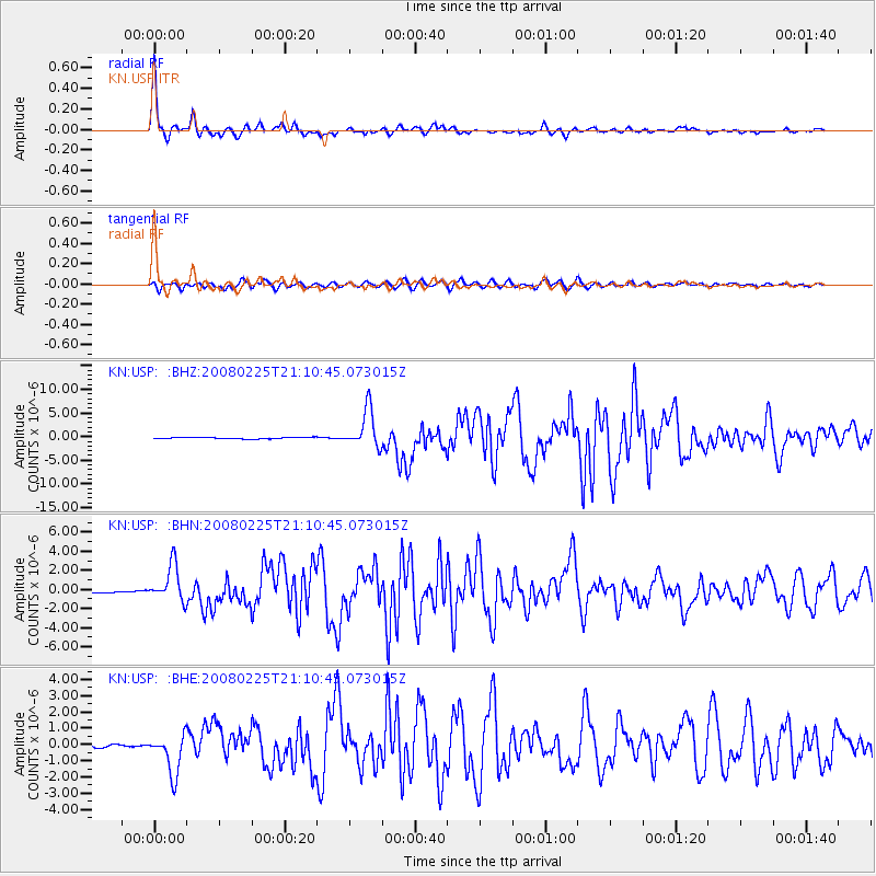
Signal To Noise
| Channel | StoN | STA | LTA |
| KN:USP: :BHN:20080225T21:10:45.073015Z | 15.018493 | 1.9322094E-6 | 1.2865534E-7 |
| KN:USP: :BHE:20080225T21:10:45.073015Z | 14.227093 | 1.2552888E-6 | 8.823228E-8 |
| KN:USP: :BHZ:20080225T21:10:45.073015Z | 24.209753 | 4.030722E-6 | 1.6649165E-7 |
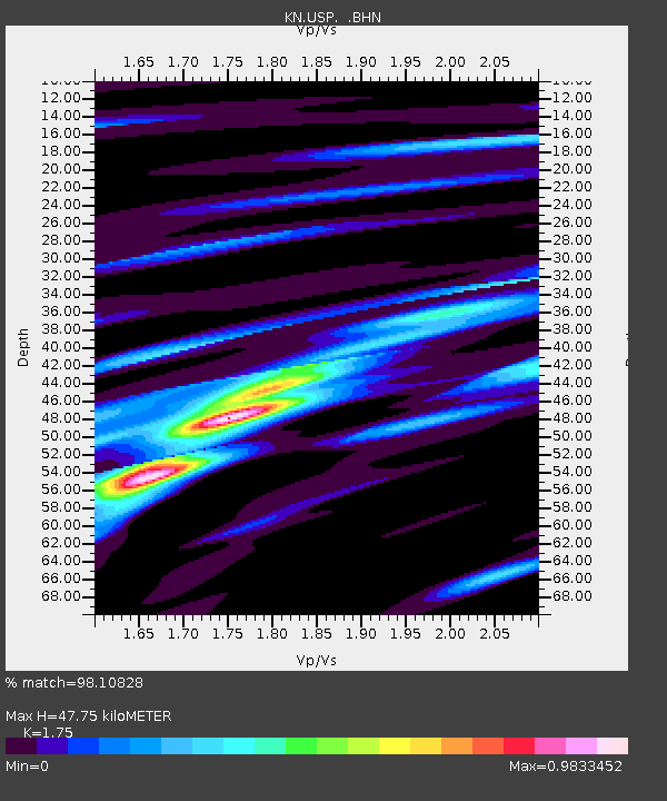
| Arrivals | |
| Ps | 6.0 SECOND |
| PpPs | 20 SECOND |
| PsPs/PpSs | 26 SECOND |

