USP KN.USP - Earthquake Result Viewer
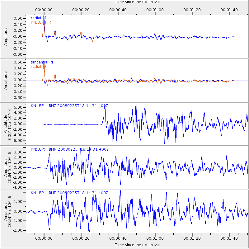
Earthquake location: Southern Sumatra, Indonesia
Earthquake latitude/longitude: -2.3/99.9
Earthquake time(UTC): 2008/02/25 (056) 18:06:03 GMT
Earthquake Depth: 25 km
Earthquake Magnitude: 6.0 MB, 6.4 MS, 6.4 MW, 6.3 MW
Earthquake Catalog/Contributor: WHDF/NEIC
Network: KN Kyrgyz Seismic Telemetry Network
Station: USP KN.USP
Lat/Lon: 43.27 N/74.50 E
Elevation: 740 m
Distance: 50.8 deg
Az: 336.167 deg
Baz: 146.446 deg
Ray Param: 0.06776195
Estimated Moho Depth: 53.5 km
Estimated Crust Vp/Vs: 1.68
Assumed Crust Vp: 6.306 km/s
Estimated Crust Vs: 3.759 km/s
Estimated Crust Poisson's Ratio: 0.22
Radial Match: 97.193665 %
Radial Bump: 337
Transverse Match: 89.05825 %
Transverse Bump: 400
SOD ConfigId: 2564
Insert Time: 2010-03-08 22:07:55.041 +0000
GWidth: 2.5
Max Bumps: 400
Tol: 0.001

Signal To Noise

ChannelStoNSTALTA
KN:USP: :BHN:20080225T18:14:31.400Z15.750579.955455E-76.320695E-8
KN:USP: :BHE:20080225T18:14:31.400Z9.9650916.9678055E-76.9922145E-8
KN:USP: :BHZ:20080225T18:14:31.400Z36.2396932.4206834E-66.679647E-8
Arrivals
Ps6.1 SECOND
PpPs21 SECOND
PsPs/PpSs28 SECOND