
USP KN.USP - Earthquake Result Viewer
| ||||||||||||||||||
| ||||||||||||||||||
| ||||||||||||||||||
|
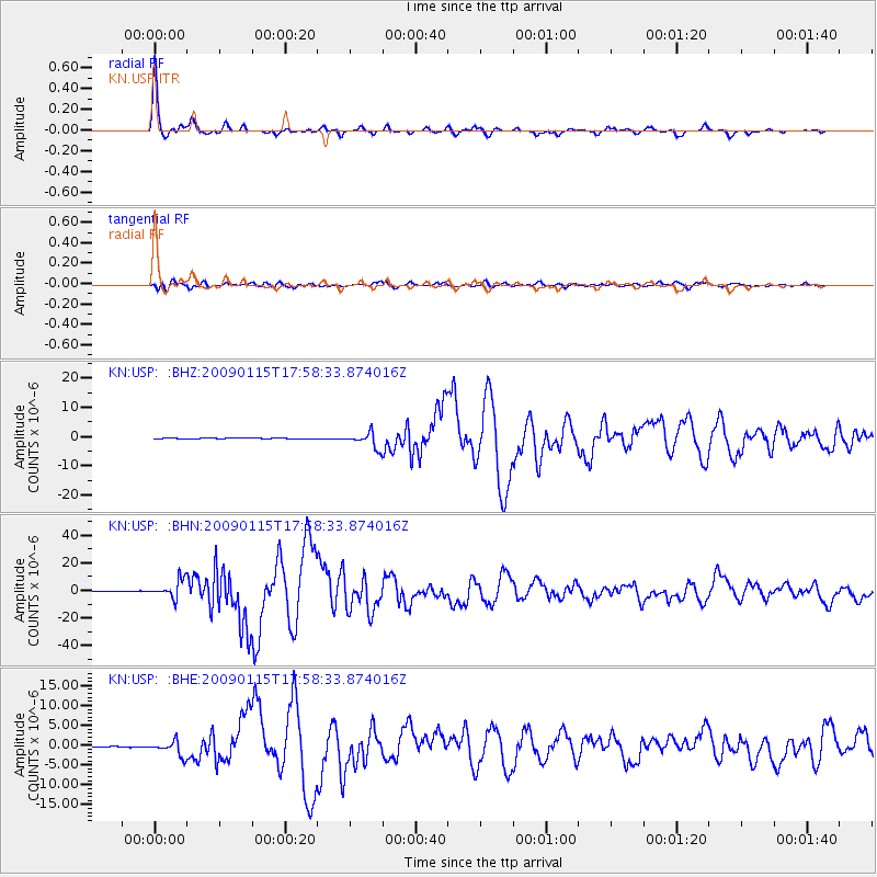
Signal To Noise
| Channel | StoN | STA | LTA |
| KN:USP: :BHN:20090115T17:58:33.874016Z | 50.852787 | 6.520915E-6 | 1.2823122E-7 |
| KN:USP: :BHE:20090115T17:58:33.874016Z | 24.046963 | 1.8372016E-6 | 7.640057E-8 |
| KN:USP: :BHZ:20090115T17:58:33.874016Z | 41.05827 | 2.6146593E-6 | 6.3681675E-8 |
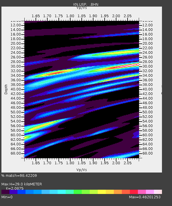
| Arrivals | |
| Ps | 5.2 SECOND |
| PpPs | 14 SECOND |
| PsPs/PpSs | 19 SECOND |

