
USP KN.USP - Earthquake Result Viewer
| ||||||||||||||||||
| ||||||||||||||||||
| ||||||||||||||||||
|
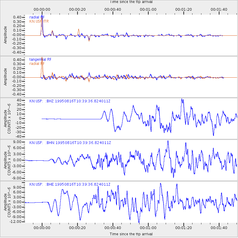
Signal To Noise
| Channel | StoN | STA | LTA |
| KN:USP: :BHN:19950816T10:39:36.824011Z | 1.1769814 | 1.5830052E-7 | 1.3449704E-7 |
| KN:USP: :BHE:19950816T10:39:36.824011Z | 16.020834 | 1.2209713E-6 | 7.6211464E-8 |
| KN:USP: :BHZ:19950816T10:39:36.824011Z | 25.921898 | 4.1899702E-6 | 1.6163825E-7 |
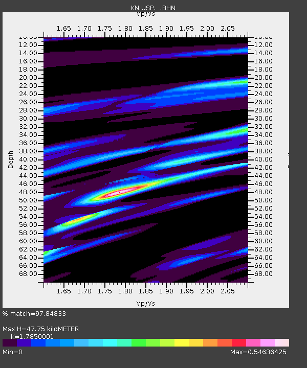
| Arrivals | |
| Ps | 6.1 SECOND |
| PpPs | 21 SECOND |
| PsPs/PpSs | 27 SECOND |

