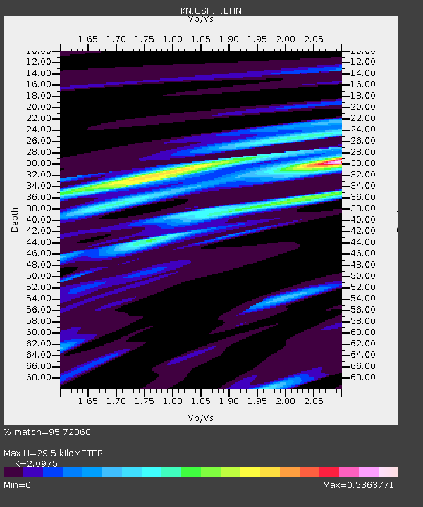
USP KN.USP - Earthquake Result Viewer
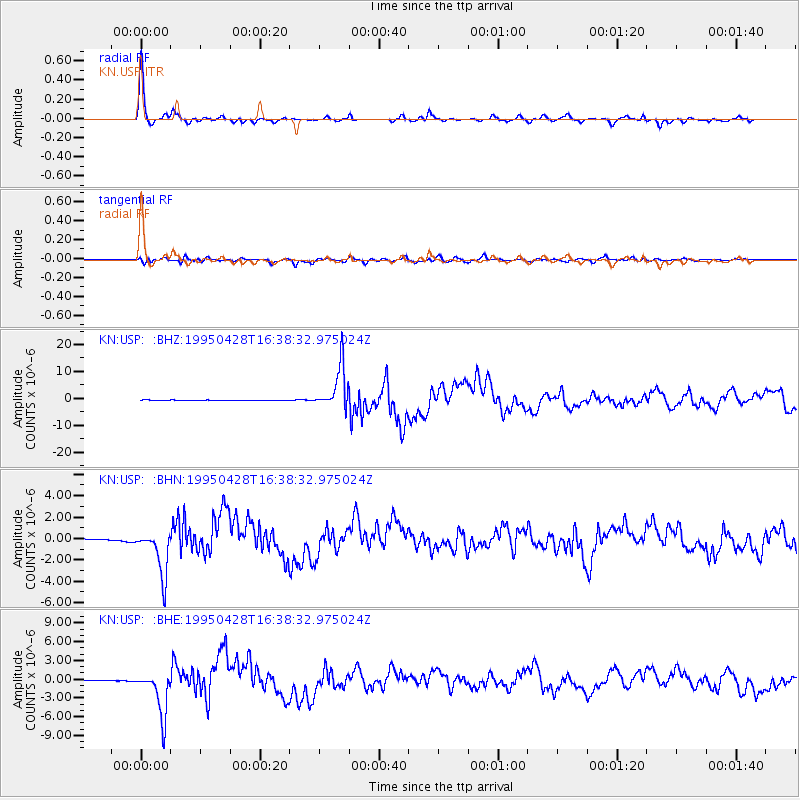
Earthquake location: Kuril Islands
Earthquake latitude/longitude: 44.1/148.1
Earthquake time(UTC): 1995/04/28 (118) 16:30:00 GMT
Earthquake Depth: 29 km
Earthquake Magnitude: 6.6 MB, 6.9 MS, 7.0 UNKNOWN, 6.8 MW
Earthquake Catalog/Contributor: WHDF/NEIC
Network: KN Kyrgyz Seismic Telemetry Network
Station: USP KN.USP
Lat/Lon: 43.27 N/74.50 E
Elevation: 740 m
Distance: 51.5 deg
Az: 296.486 deg
Baz: 62.056 deg
Ray Param: 0.06731557
Estimated Moho Depth: 29.5 km
Estimated Crust Vp/Vs: 2.10
Assumed Crust Vp: 6.306 km/s
Estimated Crust Vs: 3.006 km/s
Estimated Crust Poisson's Ratio: 0.35
Radial Match: 95.72068 %
Radial Bump: 285
Transverse Match: 85.85217 %
Transverse Bump: 400
SOD ConfigId: 6273
Insert Time: 2010-03-08 22:08:51.349 +0000
GWidth: 2.5
Max Bumps: 400
Tol: 0.001

Signal To Noise

ChannelStoNSTALTA
KN:USP: :BHN:19950428T16:38:32.975024Z31.4076042.2162244E-67.05633E-8
KN:USP: :BHE:19950428T16:38:32.975024Z88.965263.6819417E-64.1386286E-8
KN:USP: :BHZ:19950428T16:38:32.975024Z110.558767.959805E-67.199615E-8
Arrivals
Ps5.4 SECOND
PpPs14 SECOND
PsPs/PpSs19 SECOND