You are here: Home > Network List > US - United States National Seismic Network Stations List
> Station LBNH Lisbon, New Hampshire, USA > Earthquake Result Viewer
LBNH Lisbon, New Hampshire, USA - Earthquake Result Viewer

| Earthquake location: |
Near Coast Of Guatemala |
| Earthquake latitude/longitude: |
13.7/-91.1 |
| Earthquake time(UTC): |
2017/06/22 (173) 12:31:04 GMT |
| Earthquake Depth: |
10 km |
| Earthquake Magnitude: |
6.8 Mi |
| Earthquake Catalog/Contributor: |
NEIC PDE/at |
|
| Network: |
US United States National Seismic Network |
| Station: |
LBNH Lisbon, New Hampshire, USA |
| Lat/Lon: |
44.24 N/71.93 W |
| Elevation: |
367 m |
|
| Distance: |
34.6 deg |
| Az: |
24.586 deg |
| Baz: |
214.235 deg |
| Ray Param: |
0.07767385 |
| Estimated Moho Depth: |
34.0 km |
| Estimated Crust Vp/Vs: |
1.87 |
| Assumed Crust Vp: |
6.419 km/s |
| Estimated Crust Vs: |
3.433 km/s |
| Estimated Crust Poisson's Ratio: |
0.30 |
|
| Radial Match: |
91.46888 % |
| Radial Bump: |
286 |
| Transverse Match: |
66.40521 % |
| Transverse Bump: |
400 |
| SOD ConfigId: |
2140511 |
| Insert Time: |
2017-07-06 04:25:53.532 +0000 |
| GWidth: |
2.5 |
| Max Bumps: |
400 |
| Tol: |
0.001 |
|
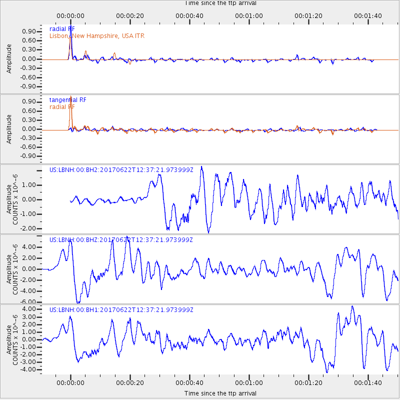
Signal To Noise
| Channel | StoN | STA | LTA |
| US:LBNH:00:BHZ:20170622T12:37:21.973999Z | 27.700682 | 4.247056E-6 | 1.5331955E-7 |
| US:LBNH:00:BH1:20170622T12:37:21.973999Z | 15.798811 | 2.190692E-6 | 1.3866183E-7 |
| US:LBNH:00:BH2:20170622T12:37:21.973999Z | 10.00255 | 1.3751272E-6 | 1.3747767E-7 |
| Arrivals |
| Ps | 5.0 SECOND |
| PpPs | 14 SECOND |
| PsPs/PpSs | 19 SECOND |


