
USP KN.USP - Earthquake Result Viewer
| ||||||||||||||||||
| ||||||||||||||||||
| ||||||||||||||||||
|
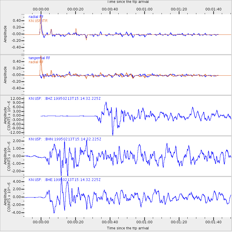
Signal To Noise
| Channel | StoN | STA | LTA |
| KN:USP: :BHN:19950213T15:14:32.225Z | 7.861427 | 4.4936874E-7 | 5.716122E-8 |
| KN:USP: :BHE:19950213T15:14:32.225Z | 10.05354 | 7.506609E-7 | 7.4666325E-8 |
| KN:USP: :BHZ:19950213T15:14:32.225Z | 26.326847 | 1.7664802E-6 | 6.709805E-8 |
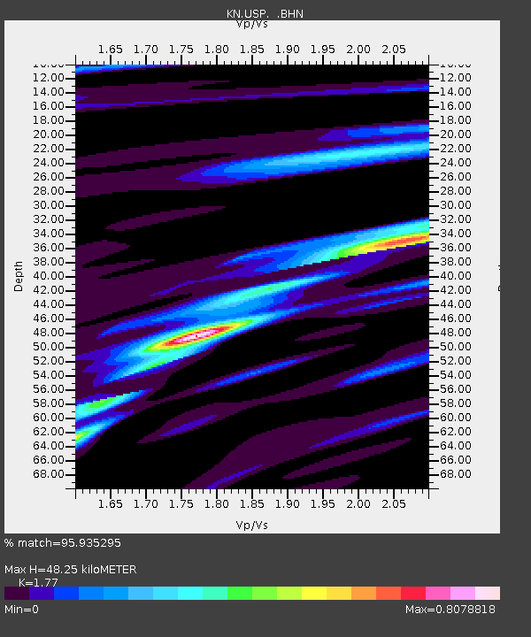
| Arrivals | |
| Ps | 6.1 SECOND |
| PpPs | 20 SECOND |
| PsPs/PpSs | 26 SECOND |

