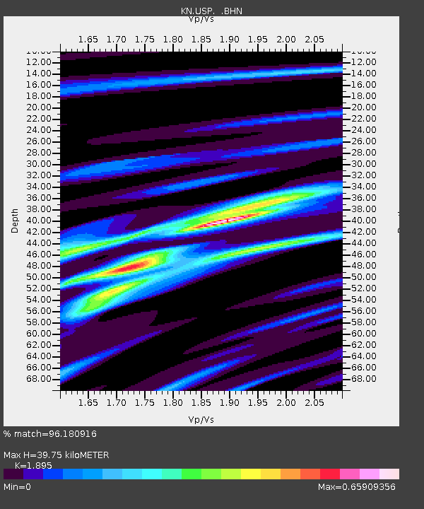
USP KN.USP - Earthquake Result Viewer
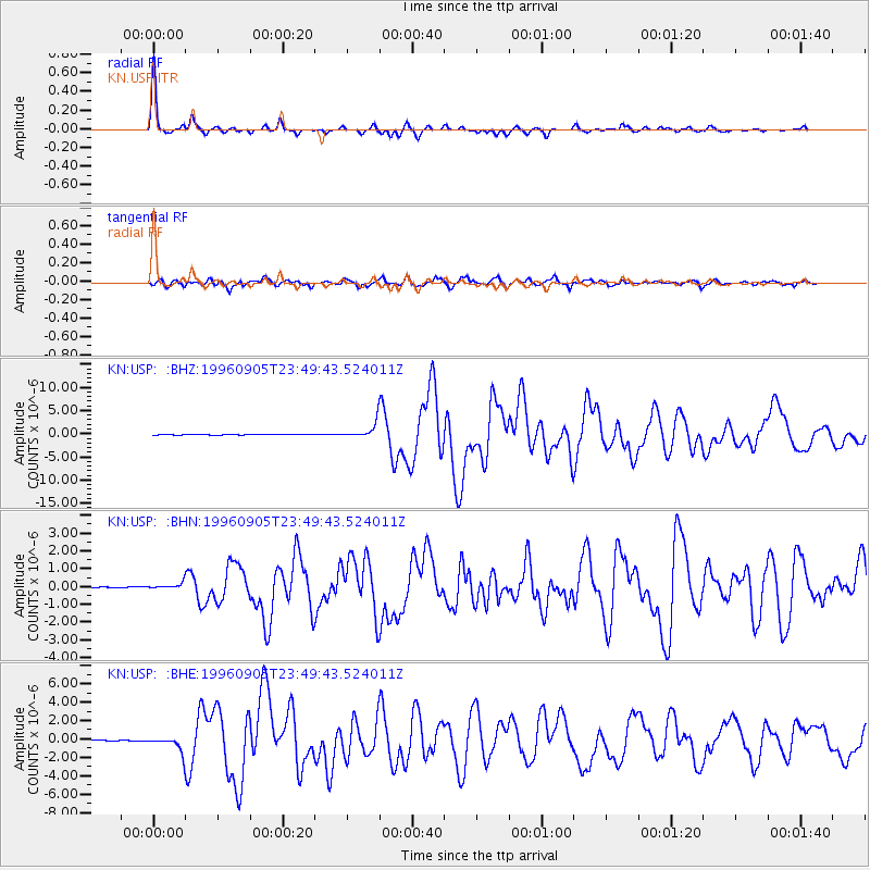
Earthquake location: Taiwan Region
Earthquake latitude/longitude: 21.9/121.5
Earthquake time(UTC): 1996/09/05 (249) 23:42:06 GMT
Earthquake Depth: 20 km
Earthquake Magnitude: 6.4 MB, 6.6 MS, 6.8 UNKNOWN, 6.8 ME
Earthquake Catalog/Contributor: WHDF/NEIC
Network: KN Kyrgyz Seismic Telemetry Network
Station: USP KN.USP
Lat/Lon: 43.27 N/74.50 E
Elevation: 740 m
Distance: 44.3 deg
Az: 310.08 deg
Baz: 103.393 deg
Ray Param: 0.07198718
Estimated Moho Depth: 39.75 km
Estimated Crust Vp/Vs: 1.89
Assumed Crust Vp: 6.306 km/s
Estimated Crust Vs: 3.328 km/s
Estimated Crust Poisson's Ratio: 0.31
Radial Match: 96.180916 %
Radial Bump: 262
Transverse Match: 84.86527 %
Transverse Bump: 400
SOD ConfigId: 6273
Insert Time: 2010-03-08 22:10:06.796 +0000
GWidth: 2.5
Max Bumps: 400
Tol: 0.001

Signal To Noise

ChannelStoNSTALTA
KN:USP: :BHN:19960905T23:49:43.524011Z7.55801251.7220879E-72.278493E-8
KN:USP: :BHE:19960905T23:49:43.524011Z23.1248768.253567E-73.5691293E-8
KN:USP: :BHZ:19960905T23:49:43.524011Z42.422361.6817958E-63.964409E-8
Arrivals
Ps6.0 SECOND
PpPs17 SECOND
PsPs/PpSs23 SECOND