USP KN.USP - Earthquake Result Viewer
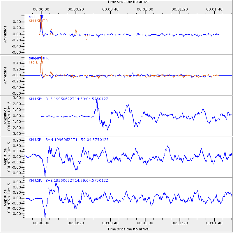
Earthquake location: Off East Coast Of Kamchatka
Earthquake latitude/longitude: 51.4/159.2
Earthquake time(UTC): 1996/06/22 (174) 14:50:07 GMT
Earthquake Depth: 33 km
Earthquake Magnitude: 5.6 MB, 6.0 MS, 6.2 UNKNOWN, 6.2 MW
Earthquake Catalog/Contributor: WHDF/NEIC
Network: KN Kyrgyz Seismic Telemetry Network
Station: USP KN.USP
Lat/Lon: 43.27 N/74.50 E
Elevation: 740 m
Distance: 55.0 deg
Az: 297.313 deg
Baz: 49.642 deg
Ray Param: 0.065055765
Estimated Moho Depth: 41.75 km
Estimated Crust Vp/Vs: 1.83
Assumed Crust Vp: 6.306 km/s
Estimated Crust Vs: 3.455 km/s
Estimated Crust Poisson's Ratio: 0.29
Radial Match: 95.76736 %
Radial Bump: 333
Transverse Match: 75.97389 %
Transverse Bump: 400
SOD ConfigId: 6273
Insert Time: 2010-03-08 22:10:14.822 +0000
GWidth: 2.5
Max Bumps: 400
Tol: 0.001

Signal To Noise

ChannelStoNSTALTA
KN:USP: :BHN:19960622T14:59:04.575012Z7.98998264.8207374E-76.033477E-8
KN:USP: :BHE:19960622T14:59:04.575012Z13.5828914.7173933E-73.473041E-8
KN:USP: :BHZ:19960622T14:59:04.575012Z16.921961.2519736E-67.3985134E-8
Arrivals
Ps5.7 SECOND
PpPs18 SECOND
PsPs/PpSs24 SECOND