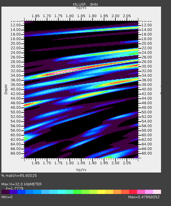
USP KN.USP - Earthquake Result Viewer
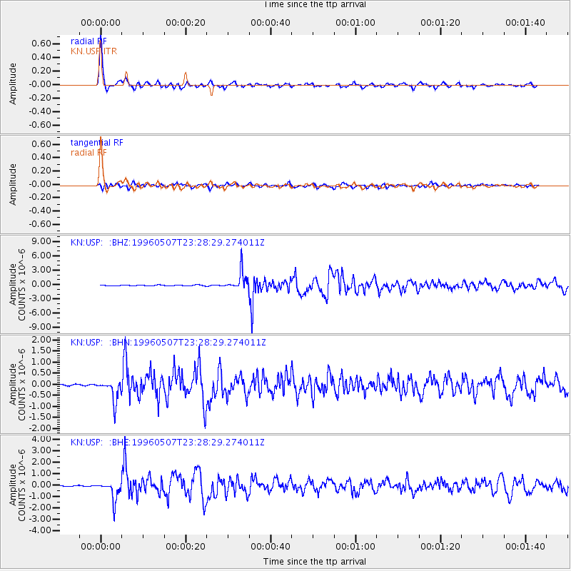
Earthquake location: Kuril Islands
Earthquake latitude/longitude: 43.7/147.6
Earthquake time(UTC): 1996/05/07 (128) 23:20:00 GMT
Earthquake Depth: 54 km
Earthquake Magnitude: 6.2 MB, 5.6 MS, 6.2 UNKNOWN, 5.2 MS
Earthquake Catalog/Contributor: WHDF/NEIC
Network: KN Kyrgyz Seismic Telemetry Network
Station: USP KN.USP
Lat/Lon: 43.27 N/74.50 E
Elevation: 740 m
Distance: 51.4 deg
Az: 296.542 deg
Baz: 62.641 deg
Ray Param: 0.06731241
Estimated Moho Depth: 32.0 km
Estimated Crust Vp/Vs: 1.78
Assumed Crust Vp: 6.306 km/s
Estimated Crust Vs: 3.548 km/s
Estimated Crust Poisson's Ratio: 0.27
Radial Match: 95.80025 %
Radial Bump: 400
Transverse Match: 84.77308 %
Transverse Bump: 400
SOD ConfigId: 6273
Insert Time: 2010-03-08 22:10:26.268 +0000
GWidth: 2.5
Max Bumps: 400
Tol: 0.001

Signal To Noise

ChannelStoNSTALTA
KN:USP: :BHN:19960507T23:28:29.274011Z10.8275264.911268E-74.5359094E-8
KN:USP: :BHE:19960507T23:28:29.274011Z31.283458.651795E-72.7656142E-8
KN:USP: :BHZ:19960507T23:28:29.274011Z21.3197821.9909714E-69.3386106E-8
Arrivals
Ps4.2 SECOND
PpPs13 SECOND
PsPs/PpSs18 SECOND