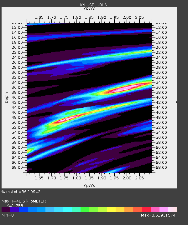
USP KN.USP - Earthquake Result Viewer
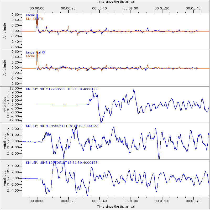
Earthquake location: Samar, Philippines
Earthquake latitude/longitude: 12.6/125.2
Earthquake time(UTC): 1996/06/11 (163) 18:22:55 GMT
Earthquake Depth: 33 km
Earthquake Magnitude: 6.0 MB, 7.0 MS, 7.2 UNKNOWN, 7.1 MW
Earthquake Catalog/Contributor: WHDF/NEIC
Network: KN Kyrgyz Seismic Telemetry Network
Station: USP KN.USP
Lat/Lon: 43.27 N/74.50 E
Elevation: 740 m
Distance: 53.1 deg
Az: 315.066 deg
Baz: 109.287 deg
Ray Param: 0.06625648
Estimated Moho Depth: 48.5 km
Estimated Crust Vp/Vs: 1.75
Assumed Crust Vp: 6.306 km/s
Estimated Crust Vs: 3.593 km/s
Estimated Crust Poisson's Ratio: 0.26
Radial Match: 96.10943 %
Radial Bump: 215
Transverse Match: 85.45975 %
Transverse Bump: 400
SOD ConfigId: 6273
Insert Time: 2010-03-08 22:10:31.663 +0000
GWidth: 2.5
Max Bumps: 400
Tol: 0.001

Signal To Noise

ChannelStoNSTALTA
KN:USP: :BHN:19960611T18:31:39.400012Z3.14394472.7035563E-78.599249E-8
KN:USP: :BHE:19960611T18:31:39.400012Z19.2750598.8551354E-74.59409E-8
KN:USP: :BHZ:19960611T18:31:39.400012Z31.2337761.8086947E-65.7908295E-8
Arrivals
Ps6.1 SECOND
PpPs20 SECOND
PsPs/PpSs26 SECOND