
USP KN.USP - Earthquake Result Viewer
| ||||||||||||||||||
| ||||||||||||||||||
| ||||||||||||||||||
|
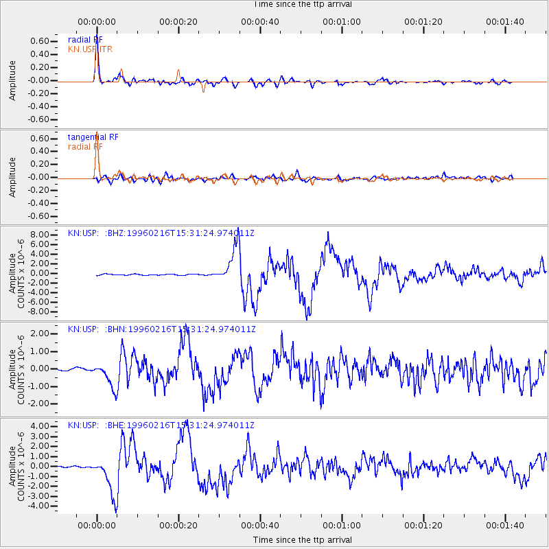
Signal To Noise
| Channel | StoN | STA | LTA |
| KN:USP: :BHN:19960216T15:31:24.974011Z | 4.660589 | 7.343781E-7 | 1.5757195E-7 |
| KN:USP: :BHE:19960216T15:31:24.974011Z | 16.921394 | 1.948554E-6 | 1.15153284E-7 |
| KN:USP: :BHZ:19960216T15:31:24.974011Z | 33.72926 | 3.997169E-6 | 1.1850746E-7 |
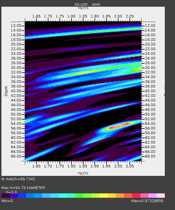
| Arrivals | |
| Ps | 9.1 SECOND |
| PpPs | 25 SECOND |
| PsPs/PpSs | 34 SECOND |

