USP KN.USP - Earthquake Result Viewer
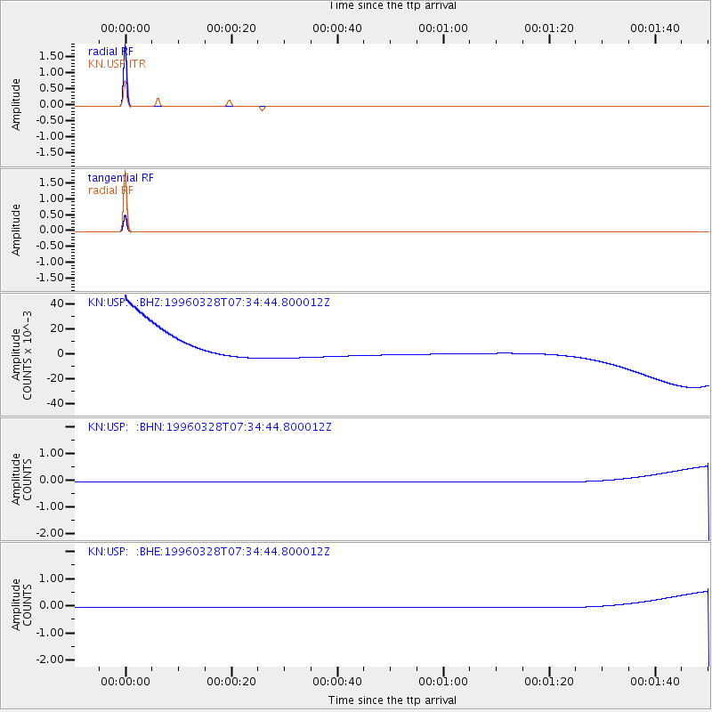
Earthquake location: Arabian Sea
Earthquake latitude/longitude: 11.9/57.8
Earthquake time(UTC): 1996/03/28 (088) 07:28:28 GMT
Earthquake Depth: 10 km
Earthquake Magnitude: 5.8 MB, 5.6 MS, 6.1 UNKNOWN, 5.9 MW
Earthquake Catalog/Contributor: WHDF/NEIC
Network: KN Kyrgyz Seismic Telemetry Network
Station: USP KN.USP
Lat/Lon: 43.27 N/74.50 E
Elevation: 740 m
Distance: 34.4 deg
Az: 21.792 deg
Baz: 209.829 deg
Ray Param: 0.07775159
Estimated Moho Depth: 10.0 km
Estimated Crust Vp/Vs: 1.60
Assumed Crust Vp: 6.306 km/s
Estimated Crust Vs: 3.941 km/s
Estimated Crust Poisson's Ratio: 0.18
Radial Match: 100.0 %
Radial Bump: 2
Transverse Match: 100.0 %
Transverse Bump: 2
SOD ConfigId: 6273
Insert Time: 2010-03-08 22:11:25.005 +0000
GWidth: 2.5
Max Bumps: 400
Tol: 0.001

Signal To Noise

ChannelStoNSTALTA
KN:USP: :BHN:19960328T07:34:44.800012Z1.04498480.014915850.014273749
KN:USP: :BHE:19960328T07:34:44.800012Z1.04498760.0149159420.014273799
KN:USP: :BHZ:19960328T07:34:44.800012Z1.04498650.0149155510.0142734395
Arrivals
Ps1.0 SECOND
PpPs3.8 SECOND
PsPs/PpSs4.8 SECOND