
USP KN.USP - Earthquake Result Viewer
| ||||||||||||||||||
| ||||||||||||||||||
| ||||||||||||||||||
|
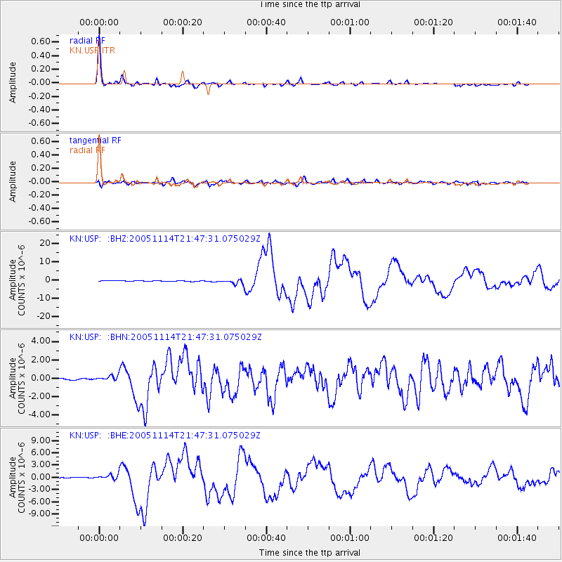
Signal To Noise
| Channel | StoN | STA | LTA |
| KN:USP: :BHN:20051114T21:47:31.075029Z | 2.6485574 | 2.9608492E-7 | 1.11791024E-7 |
| KN:USP: :BHE:20051114T21:47:31.075029Z | 3.8275685 | 7.430071E-7 | 1.9411986E-7 |
| KN:USP: :BHZ:20051114T21:47:31.075029Z | 10.154307 | 1.5083659E-6 | 1.4854444E-7 |
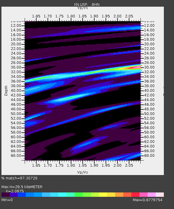
| Arrivals | |
| Ps | 5.4 SECOND |
| PpPs | 14 SECOND |
| PsPs/PpSs | 19 SECOND |

