
USP KN.USP - Earthquake Result Viewer
| ||||||||||||||||||
| ||||||||||||||||||
| ||||||||||||||||||
|
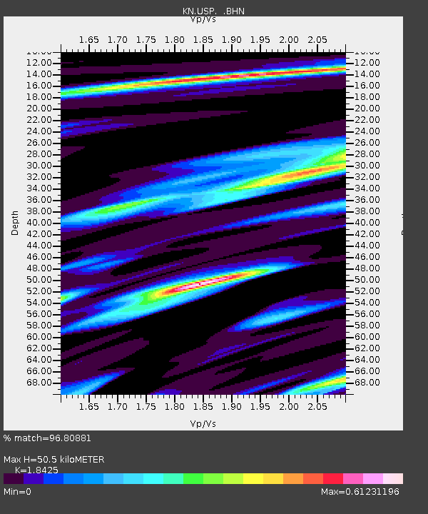
Signal To Noise
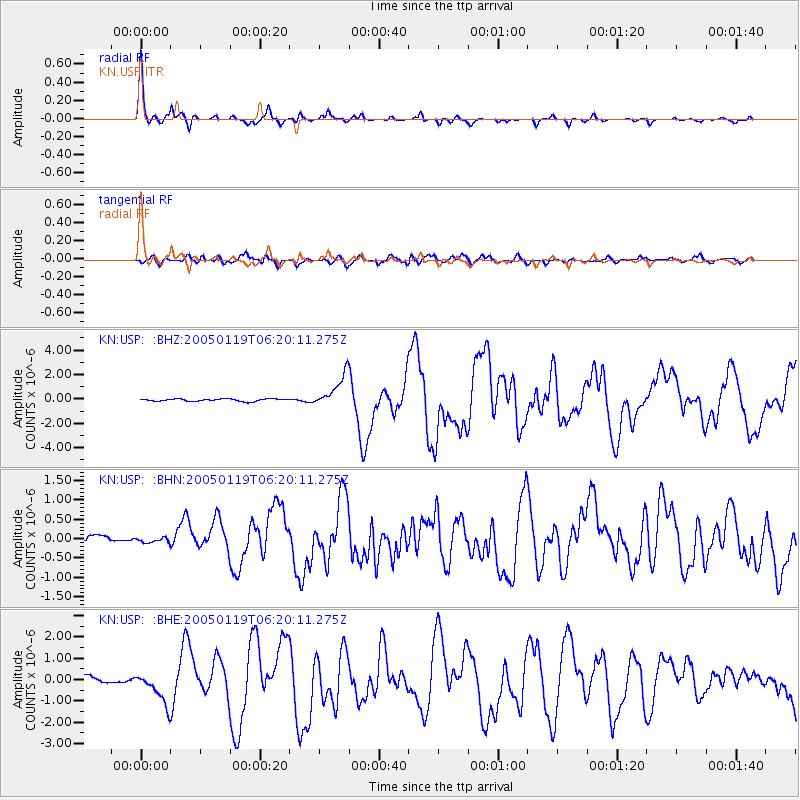
| Channel | StoN | STA | LTA |
| KN:USP: :BHN:20050119T06:20:11.275Z | 0.42157644 | 7.8357516E-8 | 1.8586788E-7 |
| KN:USP: :BHE:20050119T06:20:11.275Z | 5.5834637 | 7.495375E-7 | 1.3424238E-7 |
| KN:USP: :BHZ:20050119T06:20:11.275Z | 14.105199 | 1.3240463E-6 | 9.3869374E-8 |
| Arrivals | |
| Ps | 7.1 SECOND |
| PpPs | 22 SECOND |
| PsPs/PpSs | 29 SECOND |

