You are here: Home > Network List > TA - USArray Transportable Network (new EarthScope stations) Stations List
> Station G16K Koyuk River, AK, USA > Earthquake Result Viewer
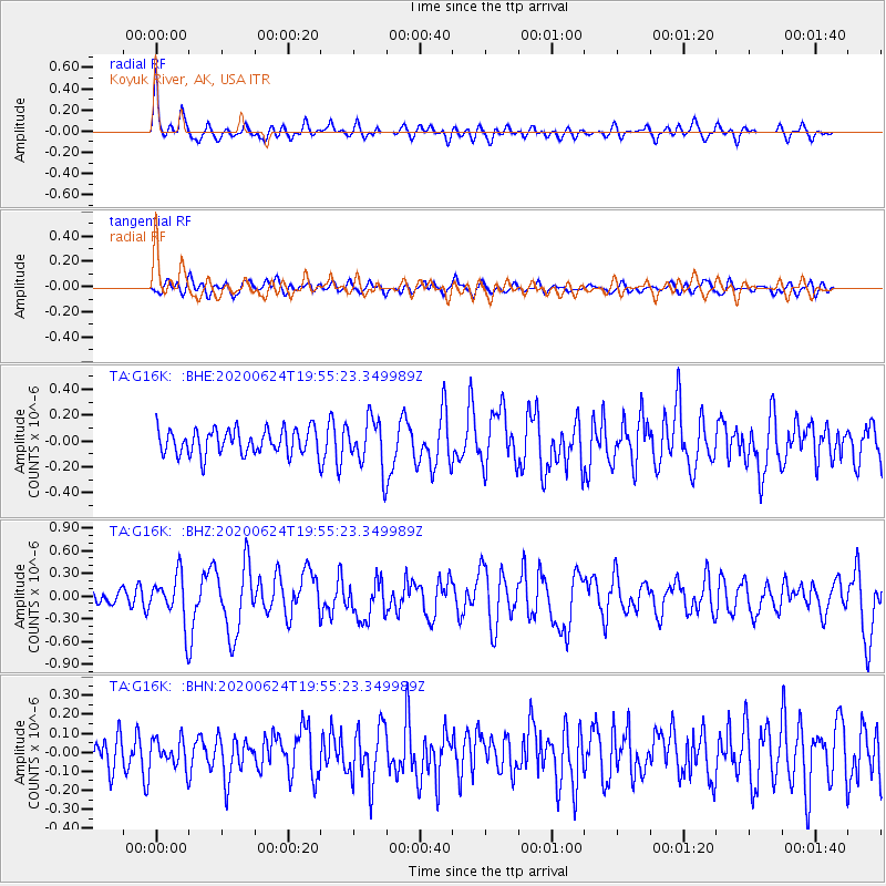
G16K Koyuk River, AK, USA - Earthquake Result Viewer
*The percent match for this event was below the threshold and hence no stack was calculated.
| Earthquake location: |
Near East Coast Of Honshu, Japan |
| Earthquake latitude/longitude: |
35.5/141.1 |
| Earthquake time(UTC): |
2020/06/24 (176) 19:47:44 GMT |
| Earthquake Depth: |
25 km |
| Earthquake Magnitude: |
5.9 mww |
| Earthquake Catalog/Contributor: |
NEIC PDE/us |
|
| Network: |
TA USArray Transportable Network (new EarthScope stations) |
| Station: |
G16K Koyuk River, AK, USA |
| Lat/Lon: |
65.39 N/162.35 W |
| Elevation: |
169 m |
|
| Distance: |
44.5 deg |
| Az: |
29.869 deg |
| Baz: |
256.191 deg |
| Ray Param: |
$rayparam |
*The percent match for this event was below the threshold and hence was not used in the summary stack. |
|
| Radial Match: |
72.105774 % |
| Radial Bump: |
400 |
| Transverse Match: |
49.19378 % |
| Transverse Bump: |
400 |
| SOD ConfigId: |
21709731 |
| Insert Time: |
2020-07-08 20:11:37.827 +0000 |
| GWidth: |
2.5 |
| Max Bumps: |
400 |
| Tol: |
0.001 |
|
Signal To Noise
| Channel | StoN | STA | LTA |
| TA:G16K: :BHZ:20200624T19:55:23.349989Z | 4.0896163 | 3.1695163E-7 | 7.750156E-8 |
| TA:G16K: :BHN:20200624T19:55:23.349989Z | 1.0343307 | 7.1963925E-8 | 6.957535E-8 |
| TA:G16K: :BHE:20200624T19:55:23.349989Z | 1.9627746 | 1.9180797E-7 | 9.772287E-8 |
| Arrivals |
| Ps | |
| PpPs | |
| PsPs/PpSs | |


