USP KN.USP - Earthquake Result Viewer
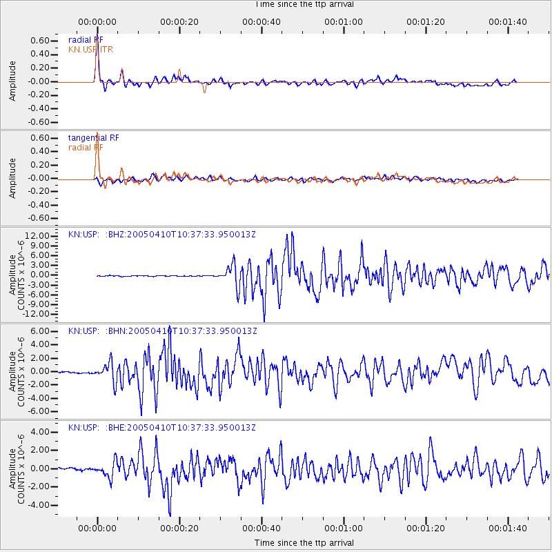
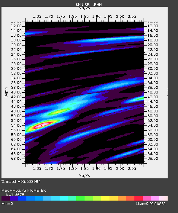
Earthquake location: Southern Sumatra, Indonesia
Earthquake latitude/longitude: -1.6/99.6
Earthquake time(UTC): 2005/04/10 (100) 10:29:11 GMT
Earthquake Depth: 19 km
Earthquake Magnitude: 6.4 MB, 6.7 MS, 6.7 MW, 6.6 MW
Earthquake Catalog/Contributor: WHDF/NEIC
Network: KN Kyrgyz Seismic Telemetry Network
Station: USP KN.USP
Lat/Lon: 43.27 N/74.50 E
Elevation: 740 m
Distance: 50.1 deg
Az: 336.163 deg
Baz: 146.425 deg
Ray Param: 0.06826975
Estimated Moho Depth: 53.75 km
Estimated Crust Vp/Vs: 1.67
Assumed Crust Vp: 6.306 km/s
Estimated Crust Vs: 3.782 km/s
Estimated Crust Poisson's Ratio: 0.22
Radial Match: 95.538994 %
Radial Bump: 400
Transverse Match: 76.74165 %
Transverse Bump: 400
SOD ConfigId: 2459
Insert Time: 2010-03-08 22:13:13.892 +0000
GWidth: 2.5
Max Bumps: 400
Tol: 0.001

Signal To Noise

ChannelStoNSTALTA
KN:USP: :BHN:20050410T10:37:33.950013Z4.8147831.4423214E-62.9956104E-7
KN:USP: :BHE:20050410T10:37:33.950013Z6.4792698.587254E-71.3253431E-7
KN:USP: :BHZ:20050410T10:37:33.950013Z34.1256983.3210476E-69.7318086E-8
Arrivals
Ps6.0 SECOND
PpPs21 SECOND
PsPs/PpSs27 SECOND