You are here: Home > Network List > US - United States National Seismic Network Stations List
> Station AMTX Amarillo, Texas, USA > Earthquake Result Viewer
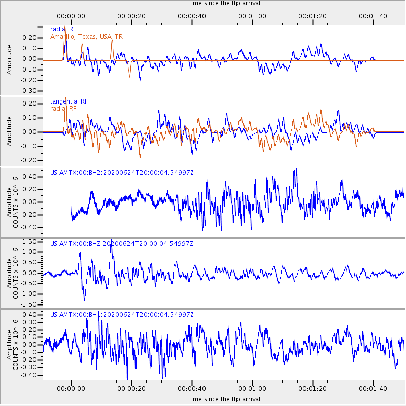
AMTX Amarillo, Texas, USA - Earthquake Result Viewer
*The percent match for this event was below the threshold and hence no stack was calculated.
| Earthquake location: |
Near East Coast Of Honshu, Japan |
| Earthquake latitude/longitude: |
35.5/141.1 |
| Earthquake time(UTC): |
2020/06/24 (176) 19:47:44 GMT |
| Earthquake Depth: |
25 km |
| Earthquake Magnitude: |
5.9 mww |
| Earthquake Catalog/Contributor: |
NEIC PDE/us |
|
| Network: |
US United States National Seismic Network |
| Station: |
AMTX Amarillo, Texas, USA |
| Lat/Lon: |
34.53 N/101.41 W |
| Elevation: |
1010 m |
|
| Distance: |
89.1 deg |
| Az: |
47.114 deg |
| Baz: |
313.568 deg |
| Ray Param: |
$rayparam |
*The percent match for this event was below the threshold and hence was not used in the summary stack. |
|
| Radial Match: |
63.850525 % |
| Radial Bump: |
400 |
| Transverse Match: |
52.40045 % |
| Transverse Bump: |
400 |
| SOD ConfigId: |
21709731 |
| Insert Time: |
2020-07-08 20:14:58.067 +0000 |
| GWidth: |
2.5 |
| Max Bumps: |
400 |
| Tol: |
0.001 |
|
Signal To Noise
| Channel | StoN | STA | LTA |
| US:AMTX:00:BHZ:20200624T20:00:04.54997Z | 7.1488886 | 5.477613E-7 | 7.662189E-8 |
| US:AMTX:00:BH1:20200624T20:00:04.54997Z | 1.2009486 | 1.11852536E-7 | 9.313682E-8 |
| US:AMTX:00:BH2:20200624T20:00:04.54997Z | 1.1662704 | 1.1546839E-7 | 9.9006535E-8 |
| Arrivals |
| Ps | |
| PpPs | |
| PsPs/PpSs | |


