USP KN.USP - Earthquake Result Viewer
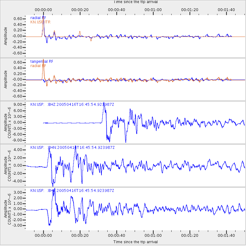
Earthquake location: Northern Sumatra, Indonesia
Earthquake latitude/longitude: 1.8/97.7
Earthquake time(UTC): 2005/04/16 (106) 16:38:03 GMT
Earthquake Depth: 31 km
Earthquake Magnitude: 6.0 MB, 6.2 MS, 6.4 MW, 6.3 MW
Earthquake Catalog/Contributor: WHDF/NEIC
Network: KN Kyrgyz Seismic Telemetry Network
Station: USP KN.USP
Lat/Lon: 43.27 N/74.50 E
Elevation: 740 m
Distance: 46.2 deg
Az: 336.523 deg
Baz: 146.968 deg
Ray Param: 0.070761956
Estimated Moho Depth: 48.75 km
Estimated Crust Vp/Vs: 1.72
Assumed Crust Vp: 6.306 km/s
Estimated Crust Vs: 3.661 km/s
Estimated Crust Poisson's Ratio: 0.25
Radial Match: 95.64166 %
Radial Bump: 384
Transverse Match: 79.34237 %
Transverse Bump: 400
SOD ConfigId: 2459
Insert Time: 2010-03-08 22:13:19.500 +0000
GWidth: 2.5
Max Bumps: 400
Tol: 0.001

Signal To Noise

ChannelStoNSTALTA
KN:USP: :BHN:20050416T16:45:54.923987Z6.40250832.0711911E-63.234968E-7
KN:USP: :BHE:20050416T16:45:54.923987Z15.1251481.4029121E-69.2753616E-8
KN:USP: :BHZ:20050416T16:45:54.923987Z90.468754.7054587E-65.2011977E-8
Arrivals
Ps5.9 SECOND
PpPs20 SECOND
PsPs/PpSs26 SECOND