
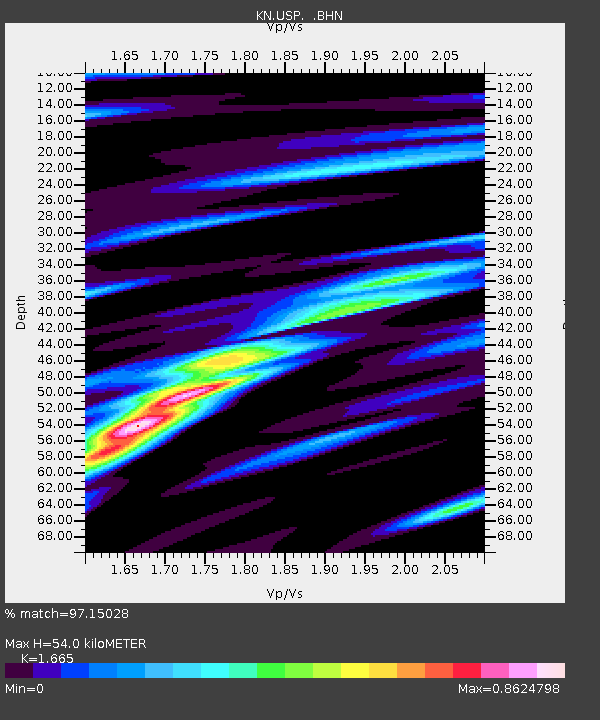
USP KN.USP - Earthquake Result Viewer
| ||||||||||||||||||
| ||||||||||||||||||
| ||||||||||||||||||
|
Signal To Noise
| Channel | StoN | STA | LTA |
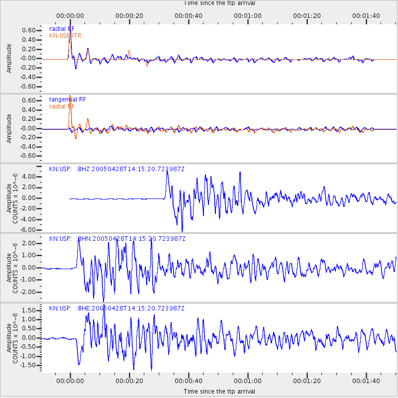
| KN:USP: :BHN:20050428T14:15:20.723987Z | 23.5838 | 8.991144E-7 | 3.8124238E-8 |
| KN:USP: :BHE:20050428T14:15:20.723987Z | 20.180037 | 5.7937274E-7 | 2.8710193E-8 |
| KN:USP: :BHZ:20050428T14:15:20.723987Z | 49.03701 | 1.9277015E-6 | 3.9311153E-8 |
| Arrivals | |
| Ps | 6.1 SECOND |
| PpPs | 21 SECOND |
| PsPs/PpSs | 27 SECOND |

