
USP KN.USP - Earthquake Result Viewer
| ||||||||||||||||||
| ||||||||||||||||||
| ||||||||||||||||||
|
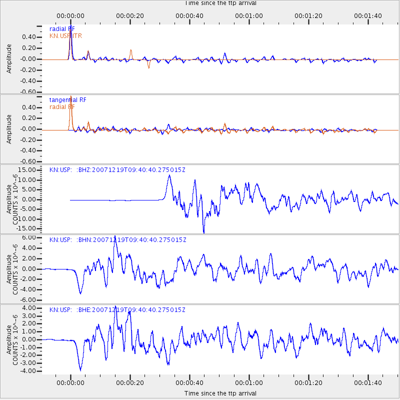
Signal To Noise
| Channel | StoN | STA | LTA |
| KN:USP: :BHN:20071219T09:40:40.275015Z | 14.643563 | 2.1553014E-6 | 1.4718421E-7 |
| KN:USP: :BHE:20071219T09:40:40.275015Z | 14.745714 | 1.7328803E-6 | 1.1751755E-7 |
| KN:USP: :BHZ:20071219T09:40:40.275015Z | 62.530758 | 5.925412E-6 | 9.4759955E-8 |
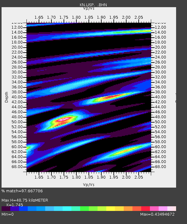
| Arrivals | |
| Ps | 6.0 SECOND |
| PpPs | 20 SECOND |
| PsPs/PpSs | 26 SECOND |

