USP KN.USP - Earthquake Result Viewer
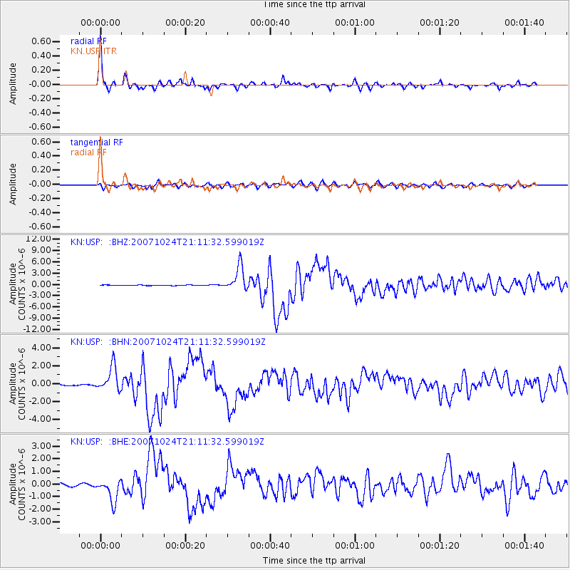
Earthquake location: Southern Sumatra, Indonesia
Earthquake latitude/longitude: -3.9/101.0
Earthquake time(UTC): 2007/10/24 (297) 21:02:50 GMT
Earthquake Depth: 20 km
Earthquake Magnitude: 6.1 MB, 6.9 MS, 6.8 MW, 6.3 ME
Earthquake Catalog/Contributor: WHDF/NEIC
Network: KN Kyrgyz Seismic Telemetry Network
Station: USP KN.USP
Lat/Lon: 43.27 N/74.50 E
Elevation: 740 m
Distance: 52.7 deg
Az: 335.795 deg
Baz: 145.944 deg
Ray Param: 0.06656966
Estimated Moho Depth: 55.0 km
Estimated Crust Vp/Vs: 1.64
Assumed Crust Vp: 6.306 km/s
Estimated Crust Vs: 3.845 km/s
Estimated Crust Poisson's Ratio: 0.20
Radial Match: 96.75964 %
Radial Bump: 305
Transverse Match: 85.149376 %
Transverse Bump: 400
SOD ConfigId: 2564
Insert Time: 2010-03-08 22:14:08.934 +0000
GWidth: 2.5
Max Bumps: 400
Tol: 0.001

Signal To Noise

ChannelStoNSTALTA
KN:USP: :BHN:20071024T21:11:32.599019Z8.835521.4664565E-61.6597286E-7
KN:USP: :BHE:20071024T21:11:32.599019Z9.1992829.190015E-79.989926E-8
KN:USP: :BHZ:20071024T21:11:32.599019Z46.862773.3757992E-67.2035846E-8
Arrivals
Ps5.9 SECOND
PpPs22 SECOND
PsPs/PpSs28 SECOND